Area Overview for SK4 1NE
Photos of SK4 1NE

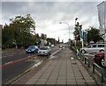
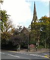


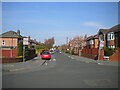
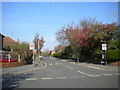

58 photos from this area
Area Information
Key information about the SK4 1NE including its size, population, and administrative classification.
- Area Type
- Postcode
- Area Size
- 7765 m²
- Population
- 1830
- Population Density
- 3598 people/km²
House Prices in SK4 1NE
60
Properties
£132,294
Average Sold Price
£25,000
Lowest Price
£242,500
Highest Price
Showing 60 properties
| Address | Type | Beds | Baths | Last Sale Price | Last Sale Date | |
|---|---|---|---|---|---|---|
| 87 Lloyd Street, Heaton Norris, Stockport, SK4 1NE | house | 2 | 1 | £242,500 | Feb 2025 | |
| 102 Lloyd Street, Heaton Norris, Stockport, SK4 1NE | Terraced | 2 | 1 | £230,500 | Aug 2023 | |
| 39 Lloyd Street, Heaton Norris, Stockport, SK4 1NE | Terraced | 1 | 4 | £239,000 | Jun 2023 | |
| 56 Lloyd Street, Heaton Norris, Stockport, SK4 1NE | house | - | - | £203,000 | Dec 2022 | |
| 69 Lloyd Street, Heaton Norris, Stockport, SK4 1NE | Terraced | 2 | 1 | £221,000 | Dec 2022 | |
| 55 Lloyd Street, Heaton Norris, Stockport, SK4 1NE | house | 2 | - | £200,000 | Aug 2022 | |
| 108 Lloyd Street, Heaton Norris, Stockport, SK4 1NE | house | 3 | - | £235,000 | Mar 2022 | |
| 83 Lloyd Street, Heaton Norris, Stockport, SK4 1NE | house | - | - | £211,174 | Feb 2022 | |
| 86 Lloyd Street, Heaton Norris, Stockport, SK4 1NE | house | - | - | £114,000 | Oct 2021 | |
| 67 Lloyd Street, Heaton Norris, Stockport, SK4 1NE | house | - | - | £142,000 | Sep 2021 |
Page 1 of 6
Energy Efficiency in SK4 1NE
Amenities
Schools
| Rank | School | Type | Entry gender | Ages |
|---|
Explore more schools in this area
Go to Schools tabDemographics
Household Size
One person
most common
Accommodation Type
Houses
most common
Tenure
40
majority
Ethnic Group
White
most common
Religion
N/A
most common
Household Composition
N/A
most common
Age
47
median
Adults (30-64 years)
most common
Household Deprivation
N/A
with no deprivation
NS-SEC
27
in Lower managerial occupations
Explore more demographic insights in this area
Go to Demographics tabPlanning
Planning Constraints
- Flood RiskPremium
- Ramsar Wetland SitesPremium
- Area of Outstanding Natural BeautyPremium
- Protected Nature ReservePremium
- Protected WoodlandPremium