Area Overview for SK3 8UN
Photos of SK3 8UN


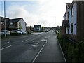
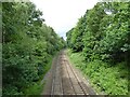


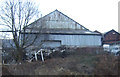

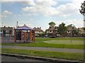
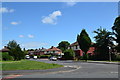
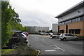
27 photos from this area
Area Information
Key information about the SK3 8UN including its size, population, and administrative classification.
- Area Type
- Postcode
- Area Size
- 2.0 hectares
- Population
- 1677
- Population Density
- 5285 people/km²
House Prices in SK3 8UN
45
Properties
£150,880
Average Sold Price
£1,995
Lowest Price
£340,000
Highest Price
Showing 45 properties
| Address | Type | Beds | Baths | Last Sale Price | Last Sale Date | |
|---|---|---|---|---|---|---|
| 29 Pintail Avenue, Adswood, Stockport, SK3 8UN | Detached | 3 | 2 | £315,000 | Aug 2025 | |
| 40 Pintail Avenue, Adswood, Stockport, SK3 8UN | Terraced | 2 | 1 | £160,000 | Jul 2025 | |
| 42 Pintail Avenue, Adswood, Stockport, SK3 8UN | Terraced | 2 | 1 | £205,000 | Sep 2024 | |
| 17 Pintail Avenue, Adswood, Stockport, SK3 8UN | Detached | 3 | 1 | £265,000 | May 2024 | |
| 35 Pintail Avenue, Adswood, Stockport, SK3 8UN | Detached | 3 | 1 | £340,000 | Aug 2023 | |
| 27 Pintail Avenue, Adswood, Stockport, SK3 8UN | Detached | 3 | 3 | £300,000 | Mar 2023 | |
| 3 Pintail Avenue, Adswood, Stockport, SK3 8UN | Detached | 3 | - | £333,000 | Aug 2022 | |
| 20 Pintail Avenue, Adswood, Stockport, SK3 8UN | house | 2 | 1 | £190,000 | Aug 2022 | |
| 34 Pintail Avenue, Adswood, Stockport, SK3 8UN | Terraced | 2 | 1 | £175,000 | Sep 2021 | |
| 5 Pintail Avenue, Adswood, Stockport, SK3 8UN | house | - | - | £280,000 | Jun 2021 |
Page 1 of 5
Energy Efficiency in SK3 8UN
Amenities
Schools
| Rank | School | Type | Entry gender | Ages |
|---|
Explore more schools in this area
Go to Schools tabDemographics
Household Size
Two person
most common
Accommodation Type
Houses
most common
Tenure
70
majority
Ethnic Group
White
most common
Religion
N/A
most common
Household Composition
N/A
most common
Age
47
median
Adults (30-64 years)
most common
Household Deprivation
N/A
with no deprivation
NS-SEC
35
in Lower managerial occupations
Explore more demographic insights in this area
Go to Demographics tabPlanning
Planning Constraints
- Flood RiskPremium
- Ramsar Wetland SitesPremium
- Area of Outstanding Natural BeautyPremium
- Protected Nature ReservePremium
- Protected WoodlandPremium