Area Overview for SK3 8SB
Photos of SK3 8SB
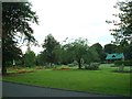
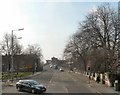
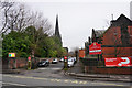
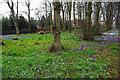
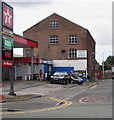
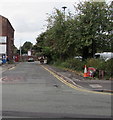
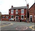
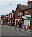
73 photos from this area
Area Information
Key information about the SK3 8SB including its size, population, and administrative classification.
- Area Type
- Postcode
- Area Size
- 1.8 hectares
- Population
- 1642
- Population Density
- 4237 people/km²
House Prices in SK3 8SB
48
Properties
£141,815
Average Sold Price
£43,000
Lowest Price
£500,000
Highest Price
Showing 48 properties
| Address | Type | Beds | Baths | Last Sale Price | Last Sale Date | |
|---|---|---|---|---|---|---|
| 5, Kennerley Lodge, 140 Bramhall Lane, Davenport, Stockport, SK3 8SB | Flat | - | - | £155,500 | Feb 2023 | |
| 160 Bramhall Lane, Davenport, Stockport, SK3 8SB | house | - | - | £266,000 | Oct 2022 | |
| 16, Kennerley Lodge, 140 Bramhall Lane, Davenport, Stockport, SK3 8SB | Flat | - | - | £120,000 | Aug 2022 | |
| 134A Bramhall Lane, Davenport, Stockport, SK3 8SB | Flat | - | - | £100,000 | Sep 2021 | |
| 19, Kennerley Lodge, 140 Bramhall Lane, Davenport, Stockport, SK3 8SB | Flat | - | - | £114,000 | Jul 2021 | |
| 8, Kennerley Lodge, 140 Bramhall Lane, Davenport, Stockport, SK3 8SB | Flat | - | - | £135,000 | Sep 2020 | |
| 138 Bramhall Lane, Davenport, Stockport, SK3 8SB | Semi-detached | 5 | - | £500,000 | Feb 2020 | |
| 15, Kennerley Lodge, 140 Bramhall Lane, Davenport, Stockport, SK3 8SB | Flat | - | - | £118,000 | Oct 2016 | |
| 146 Bramhall Lane, Davenport, Stockport, SK3 8SB | house | - | - | £280,000 | Jun 2016 | |
| 148 Bramhall Lane, Davenport, Stockport, SK3 8SB | house | - | - | £228,000 | Mar 2016 |
Page 1 of 5
Energy Efficiency in SK3 8SB
Amenities
Schools
| Rank | School | Type | Entry gender | Ages |
|---|
Explore more schools in this area
Go to Schools tabDemographics
Household Size
One person
most common
Accommodation Type
Flats
most common
Tenure
57
majority
Ethnic Group
White
most common
Religion
N/A
most common
Household Composition
N/A
most common
Age
47
median
Adults (30-64 years)
most common
Household Deprivation
N/A
with no deprivation
NS-SEC
41
in Lower managerial occupations
Explore more demographic insights in this area
Go to Demographics tabPlanning
Planning Constraints
- Flood RiskPremium
- Ramsar Wetland SitesPremium
- Area of Outstanding Natural BeautyPremium
- Protected Nature ReservePremium
- Protected WoodlandPremium