Area Overview for SK3 8QZ
Photos of SK3 8QZ
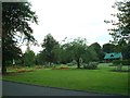
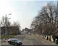
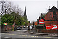
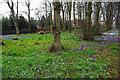
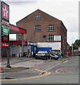
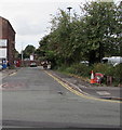
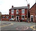
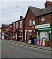
73 photos from this area
Area Information
Key information about the SK3 8QZ including its size, population, and administrative classification.
- Area Type
- Postcode
- Area Size
- 1.1 hectares
- Population
- 1615
- Population Density
- 4621 people/km²
House Prices in SK3 8QZ
19
Properties
£199,677
Average Sold Price
£37,500
Lowest Price
£425,000
Highest Price
Showing 19 properties
| Address | Type | Beds | Baths | Last Sale Price | Last Sale Date | |
|---|---|---|---|---|---|---|
| 93 Garners Lane, Davenport, Stockport, SK3 8QZ | Semi-detached | 4 | 2 | £415,000 | Nov 2022 | |
| 63 Garners Lane, Davenport, Stockport, SK3 8QZ | Semi-detached | 3 | 1 | £390,000 | Jul 2022 | |
| 73 Garners Lane, Davenport, Stockport, SK3 8QZ | house | - | - | £425,000 | Sep 2021 | |
| 91 Garners Lane, Davenport, Stockport, SK3 8QZ | Semi-detached | 4 | 1 | £322,500 | Nov 2020 | |
| 67 Garners Lane, Davenport, Stockport, SK3 8QZ | Semi-detached | 3 | - | £280,000 | Aug 2016 | |
| 65 Garners Lane, Davenport, Stockport, SK3 8QZ | Semi-detached | 3 | - | £222,500 | Dec 2014 | |
| 71 Garners Lane, Davenport, Stockport, SK3 8QZ | Semi-detached | 3 | - | £185,000 | Jan 2010 | |
| 77 Garners Lane, Davenport, Stockport, SK3 8QZ | Bungalow | 3 | 1 | £286,500 | Oct 2005 | |
| 99 Garners Lane, Davenport, Stockport, SK3 8QZ | Semi-detached | - | - | £92,000 | Aug 2001 | |
| 107 Garners Lane, Davenport, Stockport, SK3 8QZ | Semi-detached | - | - | £58,750 | Sep 1998 |
Page 1 of 2
Energy Efficiency in SK3 8QZ
Amenities
Schools
| Rank | School | Type | Entry gender | Ages |
|---|
Explore more schools in this area
Go to Schools tabDemographics
Household Size
Family (3-5 people)
most common
Accommodation Type
Houses
most common
Tenure
86
majority
Ethnic Group
White
most common
Religion
N/A
most common
Household Composition
N/A
most common
Age
47
median
Adults (30-64 years)
most common
Household Deprivation
N/A
with no deprivation
NS-SEC
46
in Lower managerial occupations
Explore more demographic insights in this area
Go to Demographics tabPlanning
Planning Constraints
- Flood RiskPremium
- Ramsar Wetland SitesPremium
- Area of Outstanding Natural BeautyPremium
- Protected Nature ReservePremium
- Protected WoodlandPremium