Area Overview for SK3 0RL
Photos of SK3 0RL
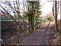


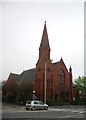
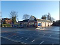
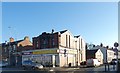

53 photos from this area
Area Information
Key information about the SK3 0RL including its size, population, and administrative classification.
- Area Type
- Postcode
- Area Size
- 4004 m²
- Population
- 1412
- Population Density
- 3193 people/km²
House Prices in SK3 0RL
10
Properties
£204,643
Average Sold Price
£120,000
Lowest Price
£410,000
Highest Price
Showing 10 properties
| Address | Type | Beds | Baths | Last Sale Price | Last Sale Date | |
|---|---|---|---|---|---|---|
| 305 Edgeley Road, Cheadle Heath, Stockport, SK3 0RL | Semi-detached | 3 | 1 | £410,000 | Nov 2022 | |
| 315 Edgeley Road, Cheadle Heath, Stockport, SK3 0RL | Semi-detached | 3 | - | £242,000 | Jan 2019 | |
| 317 Edgeley Road, Cheadle Heath, Stockport, SK3 0RL | house | 3 | - | £173,500 | Jan 2011 | |
| 319 Edgeley Road, Cheadle Heath, Stockport, SK3 0RL | house | - | - | £160,000 | Mar 2010 | |
| 301 Edgeley Road, Cheadle Heath, Stockport, SK3 0RL | house | - | - | £162,500 | Feb 2009 | |
| 313 Edgeley Road, Cheadle Heath, Stockport, SK3 0RL | Semi-detached | - | - | £164,500 | Mar 2007 | |
| 303 Edgeley Road, Cheadle Heath, Stockport, SK3 0RL | house | - | - | £120,000 | Dec 2002 | |
| 311 Edgeley Road, Cheadle Heath, Stockport, SK3 0RL | Semi-detached | - | - | - | - | |
| 307 Edgeley Road, Cheadle Heath, Stockport, SK3 0RL | Semi-detached | - | - | - | - | |
| 309 Edgeley Road, Cheadle Heath, Stockport, SK3 0RL | Semi-detached | - | - | - | - |
Energy Efficiency in SK3 0RL
Amenities
Schools
| Rank | School | Type | Entry gender | Ages |
|---|
Explore more schools in this area
Go to Schools tabDemographics
Household Size
One person
most common
Accommodation Type
Houses
most common
Tenure
69
majority
Ethnic Group
White
most common
Religion
N/A
most common
Household Composition
N/A
most common
Age
47
median
Adults (30-64 years)
most common
Household Deprivation
N/A
with no deprivation
NS-SEC
33
in Lower managerial occupations
Explore more demographic insights in this area
Go to Demographics tabPlanning
Planning Constraints
- Flood RiskPremium
- Ramsar Wetland SitesPremium
- Area of Outstanding Natural BeautyPremium
- Protected Nature ReservePremium
- Protected WoodlandPremium