Area Overview for SK2 7NB
Photos of SK2 7NB
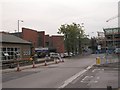
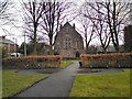
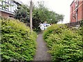
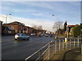

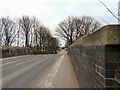
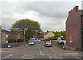
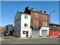
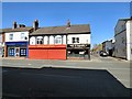

58 photos from this area
Area Information
Key information about the SK2 7NB including its size, population, and administrative classification.
- Area Type
- Postcode
- Area Size
- 1.8 hectares
- Population
- 1192
- Population Density
- 2361 people/km²
House Prices in SK2 7NB
35
Properties
£186,884
Average Sold Price
£49,950
Lowest Price
£328,000
Highest Price
Showing 35 properties
| Address | Type | Beds | Baths | Last Sale Price | Last Sale Date | |
|---|---|---|---|---|---|---|
| 23 Cruttenden Road, Offerton, Stockport, SK2 7NB | Semi-detached | 3 | 1 | £328,000 | Aug 2025 | |
| 22 Cruttenden Road, Offerton, Stockport, SK2 7NB | Semi-detached | 3 | 1 | £279,950 | Jan 2024 | |
| 4 Cruttenden Road, Offerton, Stockport, SK2 7NB | Semi-detached | 3 | 1 | £315,000 | Apr 2023 | |
| 3 Cruttenden Road, Offerton, Stockport, SK2 7NB | house | - | - | £190,000 | Jul 2021 | |
| 5 Cruttenden Road, Offerton, Stockport, SK2 7NB | house | - | - | £216,000 | Mar 2021 | |
| 21 Cruttenden Road, Offerton, Stockport, SK2 7NB | house | 3 | - | £238,500 | Jan 2021 | |
| 9 Cruttenden Road, Offerton, Stockport, SK2 7NB | Semi-detached | 3 | 1 | £254,500 | Dec 2019 | |
| 8 Cruttenden Road, Offerton, Stockport, SK2 7NB | Semi-detached | 4 | 2 | £260,000 | Aug 2019 | |
| 15 Cruttenden Road, Offerton, Stockport, SK2 7NB | Semi-detached | 3 | 1 | £195,000 | Jul 2018 | |
| 1 Cruttenden Road, Offerton, Stockport, SK2 7NB | Semi-detached | 3 | 1 | £195,000 | Feb 2018 |
Page 1 of 4
Energy Efficiency in SK2 7NB
Amenities
Schools
| Rank | School | Type | Entry gender | Ages |
|---|
Explore more schools in this area
Go to Schools tabDemographics
Household Size
Family (3-5 people)
most common
Accommodation Type
Houses
most common
Tenure
58
majority
Ethnic Group
White
most common
Religion
N/A
most common
Household Composition
N/A
most common
Age
47
median
Adults (30-64 years)
most common
Household Deprivation
N/A
with no deprivation
NS-SEC
28
in Lower managerial occupations
Explore more demographic insights in this area
Go to Demographics tabPlanning
Planning Constraints
- Flood RiskPremium
- Ramsar Wetland SitesPremium
- Area of Outstanding Natural BeautyPremium
- Protected Nature ReservePremium
- Protected WoodlandPremium