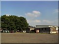
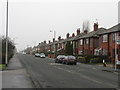
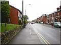
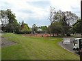
Area Overview for SK16 4WW
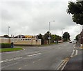
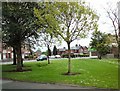
Photos of SK16 4WW


Area Information
SK16 4WW represents a specific postcode area covering a small residential cluster in Greater Manchester. The population stands at 1,282 residents, creating a distinctively compact community within the wider SK16 postcode district. Living in this area means relying on a defined residential footprint where every street contributes to the local identity. This cluster is situated close to key transport nodes, providing access to several railway stations within reach. You will find yourself living in an environment where proximity to major thoroughfares and urban centres balances peaceful residential streets. The area offers a straightforward layout typical of established English suburbs, avoiding overly dense sprawl or isolated remoteness. Many people choose SK16 4WW for its established character and practical connectivity. The small population size ensures that daily life unfolds in a focused setting rather than a sprawling metropolis. Homes in SK16 4WW cater primarily to adults, reflecting the demographic reality of the neighbourhood. While the area is not one of the largest in the region, its location places it strategically near amenities like Asda Ashton and various railway stations. The postcode 1282 residents inhabit a space designed for quiet living without sacrificing access to urban services. This specific postcode area functions as a stable pocket of the wider Manchester housing market, offering a clear sense of place for those seeking a defined environment.
- Area Type
- Postcode
- Area Size
- Not available
- Population
- 1282
- Population Density
- 5252 people/km²
The property market in SK16 4WW is defined by significant owner occupancy, with 60% of homes held by their residents. This statistic identifies the area as a primarily owner-occupied zone rather than a rental hub for mobile tenants. Most accommodation comprises houses, which naturally supports the interests of those seeking traditional family environments. Buyers looking for homes in SK16 4WW will predominantly find detached or semi-detached properties suited to established households. The high proportion of owner-occupiers suggests that the local housing stock attracts long-term investors and families who remain in one location for many years. This market structure offers specific advantages for direct buyers. You engage with current owners who have a vested interest in their property values and neighbourhood stability. The presence of 1,282 residents within this small cluster indicates a tight-knit market where property moves may be slower but often involve motivated sellers. Investors seeking high turnover rental yields might find this area less attractive compared to student-heavy zones, as the population reflects a mature age group. Instead, the focus here is on capital stability and low tenant churn. When considering SK16 4WW, expect a market driven by owner-occupiers who value their homes. The housing stock reflects a deliberate choice towards traditional living arrangements, ensuring that properties remain in use by consistent households over decades.
House Prices in SK16 4WW
No properties found in this postcode.
Energy Efficiency in SK16 4WW
Living in SK16 4WW places you moments away from a strong network of retail and leisure options. Five notable retail destinations sit within practical reach, ensuring your daily shopping needs remain simple to meet. You will find Morrisons Daily and Morrisons Dukinfield nearby, providing fresh groceries and household essentials. Asda Ashton remains a significant anchor for larger shopping trips and supermarket comparisons. Furthermore, Asda Ashton is accessible by car or public transport, allowing you to stock up on bulk items without leaving the local district. For frequent shoppers, Asda Ashton in Ashton-under-Lyne offers a dedicated stop for your weekly rounds. Public transport links enhance your ability to reach dining and entertainment venues quickly. High numbers of nearby stations, including Flowery Field and Guide Bridge, mean you can rely on trains to get to town centres at your convenience. Five railway nodes within easy access provide frequent departures to Manchester and beyond. The Metrolink network, featuring stops like Ashton West and Ashton Moss, adds another layer of connectivity. You can travel by tram to central Manchester for evenings out or business meetings. Five Metrolink stations service the wider area, ensuring you are never cut off from the city's nightlife or culture. This proximity to five distinct transport hubs means you have multiple choices for your daily journey, whether by bus or rail.
Amenities
Schools
| Rank | School | Type | Entry gender | Ages |
|---|
Explore more schools in this area
Go to Schools tabDemographics
The community in SK16 4WW displays a clear adult orientation, with a median age of 47 years. The most common age range consists of adults between 30 and 64 years old. This demographic profile suggests a neighbourhood settled by working families and established professionals rather than young students or elderly retirees. Over 60% of households report home ownership, indicating a stable residential base where long-term residents have invested in their properties. The majority of accommodation consists of houses, supporting families who require garden space and traditional layouts. There is no need to compete for limited flat spaces within this specific cluster, as the housing stock aligns with owner-occupier preferences. Ethnically, the predominant group in SK16 4WW identifies as White. This statistical reality defines the cultural fabric of the 1,282 residents living within these boundaries. The high home ownership rate means fewer tenants navigate the local streets compared to mixed rental markets found elsewhere in the Greater Manchester area. Adults forming the core population likely value stability and quiet, matching the provision of larger houses over urban flats. The age distribution reinforces a community where residential life centres around established households rather than transient populations. You will find that the social rhythm of SK16 4WW follows the patterns of middle-aged families and mature professionals. This demographic consistency creates a predictable neighbourhood dynamic for anyone moving to the area.
Household Size
Accommodation Type
Tenure
Ethnic Group
Religion
Household Composition
Age
Household Deprivation
NS-SEC
Explore more demographic insights in this area
Go to Demographics tabPlanning
Planning Constraints
- Flood RiskPremium
- Ramsar Wetland SitesPremium
- Area of Outstanding Natural BeautyPremium
- Protected Nature ReservePremium
- Protected WoodlandPremium