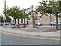
Area Overview for SK16 4LR
Photos of SK16 4LR


Area Information
Living in SK16 4LR offers residence within a specific postcode cluster designed for small residential living. This area holds a population of 1,403 people, creating a tight-knit neighbourhood with clear boundaries. The location sits off the main transit arteries but remains accessible to larger towns through connected rail and bus networks. Residents enjoy a compact environment where daily essentials are reachable without excessive travel time. The backdrop to this community is stable planning infrastructure. There are no Ramsar wetland sites, Areas of Outstanding Natural Beauty, protected nature reserves, or protected woodland covering the immediate grounds. As a result, flooding presents a minimal concern, with risk coverage scoring zero on the safety scale. This lack of environmental constraints simplifies long-term planning for homeowners. You gain a clear understanding of your property's prospects without worrying about hidden planning restrictions or flood defences. Daily life here revolves around practicality and proximity. The area functions as a quiet residential extension to the wider Greater Manchester region. It avoids the congestion of central city living while maintaining strong links to shopping hubs and transport interchanges. For anyone considering homes in SK16 4LR, the environment provides a straightforward, low-maintenance setting where the focus remains on domestic comfort rather than navigating complex conservation designations.
- Area Type
- Postcode
- Area Size
- Not available
- Population
- 1403
- Population Density
- 6959 people/km²
The property market in SK16 4LR is defined almost exclusively by houses. Accommodation types here are purely single-family dwellings, meaning buyers here seek properties with more land and private outdoor space than those found in urban flats. This structural reality shapes the buyer pool significantly. The current market is not a sea of high-rise conversions or studio apartments; it is a collection of traditional homes suited to families or those requiring separation from neighbours. Home ownership sits at a moderate level, with 38% of residents owning their property. This figure implies that the remaining 62% either rent or are first-time buyers struggling to enter the ladder. For those looking at homes in SK16 4LR, the low percentage of ownership suggests that while there are decent stock of owned properties, rental options and affordable entry points might also be prevalent. The market is likely competitive for buyers seeking good value, as many residents are established homeowners rather than new investors. You will find a stock of properties that cater to specific needs rather than general urban living trends. The housing stock is consistent with the area's median age, meaning the buildings are often mature structures rather than new builds. Buyers here must be ready for older housing stock without the promise of modern renovation incentives. The focus remains on securing a permanent residence within a very specific postcode, rather than viewing properties as part of a larger, diversified development scheme.
House Prices in SK16 4LR
Showing 33 properties
| Address | Type | Beds | Baths | Last Sale Price | Last Sale Date | |
|---|---|---|---|---|---|---|
| 28, Lakeswood, Church Street, Dukinfield, SK16 4LR | Flat | - | - | - | - | |
| 4, Lakeswood, Church Street, Dukinfield, SK16 4LR | Flat | - | - | - | - | |
| 9, Lakeswood, Church Street, Dukinfield, SK16 4LR | Flat | - | - | - | - | |
| 12, Lakeswood, Church Street, Dukinfield, SK16 4LR | Flat | - | - | - | - | |
| 3, Lakeswood, Church Street, Dukinfield, SK16 4LR | Flat | - | - | - | - | |
| 33, Lakeswood, Church Street, Dukinfield, SK16 4LR | Flat | - | - | - | - | |
| 32, Lakeswood, Church Street, Dukinfield, SK16 4LR | Flat | - | - | - | - | |
| 2, Lakeswood, Church Street, Dukinfield, SK16 4LR | Flat | - | - | - | - | |
| 1, Lakeswood, Church Street, Dukinfield, SK16 4LR | Bungalow | - | - | - | - | |
| 18, Lakeswood, Church Street, Dukinfield, SK16 4LR | Flat | - | - | - | - |
Energy Efficiency in SK16 4LR
Your daily routine in SK16 4LR revolves around a network of practical amenities located within practical reach. Retail options include five nearby venues, headlined by Morrisons Daily, Morrisons Dukinfield, and Asda Ashton. These stores provide comprehensive shopping needs, from fresh groceries to household essentials, all reachable without travelling into the congested city centre. You can manage your weekly shop and other retail tasks efficiently. Transport links further enhance your convenience. Five rail stations serve the area, including Guide Bridge Railway Station, Hyde North Railway Station, and Ashton. These stations offer direct access to major employment hubs, stabilising your commute time and costing you less in fuel and parking. Additionally, five metro stops are available, covering Ashton West, Ashton Moss, and Audenshaw, providing a complementary rapid transit option. Bus connectivity adds a layer of flexibility with routes serving stations like Chorlton Street Coach Station. The integration of rail, metro, and bus networks means you have multiple ways to reach your destination. This multi-modal approach to transport makes SK16 4LR a strategic base for those working in Manchester or surrounding towns. You gain the convenience of a suburban home with the connectivity of a town. The presence of these five retail outlets and nine transport nodes ensures that your lifestyle remains active and unblemished by isolation.
Amenities
Schools
Families considering SK16 4LR have access to specific educational institutions within their immediate vicinity. The primary education landscape is anchored by Clarendon Fields Primary School and Ravensfield Primary School. Both schools operate at the primary level, offering a complete educational pathway for younger children living in this postcode. For parents looking at schools near SK16 4LR, the presence of these two named institutions provides certainty. They are local assets integrated into the community structure. While the current dataset does not specify Ofsted ratings or review scores, the existence of these schools indicates a designated area of provision for early education. You do not need to travel far to secure primary schooling for your child. The dominance of primary schools in the data suggests that secondary education options lie just beyond this specific postcode boundary. Residents likely commute to larger towns for high school education. The current mix means young families in SK16 4LR rely heavily on these local primary academies. If you are buying a home here, the proximity to Clarendon Fields and Ravensfield ensures that early years education is a short drive away. The area serves as a catchment zone for these specific colleges, creating a defined educational community for pupils aged up to eleven.
| Rank | School | Type | Entry gender | Ages |
|---|
Explore more schools in this area
Go to Schools tabDemographics
The community comprising SK16 4LR skews significantly towards mature adults. The median age stands at 47 years, which confirms the area is predominantly inhabited by those aged between 30 and 64 years. This demographic profile suggests a neighbourhood built for families with older children or couples approaching retirement rather than young professionals just entering the market. The population composition is largely homogeneous, with White residents forming the predominant ethnic group. Housing ownership plays a major role in the character of the area. Currently, 38% of the population owns their homes outright or via mortgage. The remaining households are likely renting. The standard of accommodation is strictly residential houses, meaning you will not find flats or apartments within this specific postcode. This structural makeup dictates a lifestyle centred on garden space and detached or semi-detached living arrangements. Deprivation metrics are absent from the current records for this cluster, so no specific analysis of income levels or deprivation can be provided. Instead, the data points clearly to a steady, middle-aged demographic settled into substantial housing. You are looking at an environment where long-term residents outnumber transient occupants, fostering a stable social fabric. The mix of owners and renters indicates a balanced market where affordability concerns coexist with the desire for a permanent foothold in the region.
Household Size
Accommodation Type
Tenure
Ethnic Group
Religion
Household Composition
Age
Household Deprivation
NS-SEC
Explore more demographic insights in this area
Go to Demographics tabPlanning
Planning Constraints
- Flood RiskPremium
- Ramsar Wetland SitesPremium
- Area of Outstanding Natural BeautyPremium
- Protected Nature ReservePremium
- Protected WoodlandPremium