Area Overview for SK16 4LG
Photos of SK16 4LG
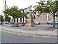
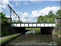
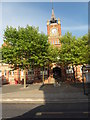
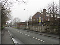
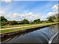
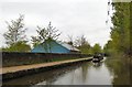
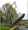
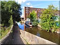
103 photos from this area
Area Information
Key information about the SK16 4LG including its size, population, and administrative classification.
- Area Type
- Postcode
- Area Size
- 1.4 hectares
- Population
- 1403
- Population Density
- 6959 people/km²
House Prices in SK16 4LG
26
Properties
£116,329
Average Sold Price
£21,000
Lowest Price
£252,000
Highest Price
Showing 26 properties
| Address | Type | Beds | Baths | Last Sale Price | Last Sale Date | |
|---|---|---|---|---|---|---|
| 142 King Street, Dukinfield, SK16 4LG | house | - | - | £252,000 | Mar 2024 | |
| 136 King Street, Dukinfield, SK16 4LG | Semi-detached | 4 | - | £130,000 | Dec 2019 | |
| 175 King Street, Dukinfield, SK16 4LG | Semi-detached | 4 | 1 | £188,000 | Dec 2017 | |
| 128 King Street, Dukinfield, SK16 4LG | Terraced | 3 | 1 | £72,000 | Jan 2015 | |
| 124 King Street, Dukinfield, SK16 4LG | house | 3 | - | £85,000 | Dec 2013 | |
| 173 King Street, Dukinfield, SK16 4LG | house | - | - | £150,000 | Aug 2013 | |
| 189 King Street, Dukinfield, SK16 4LG | Terraced | 4 | 2 | £145,000 | Dec 2010 | |
| 138 King Street, Dukinfield, SK16 4LG | house | - | - | £177,500 | Nov 2007 | |
| 171A King Street, Dukinfield, SK16 4LG | Flat | - | - | £55,000 | Oct 2007 | |
| 187 King Street, Dukinfield, SK16 4LG | Semi-detached | 3 | 1 | £86,950 | Aug 2002 |
Page 1 of 3
Energy Efficiency in SK16 4LG
Amenities
Schools
| Rank | School | Type | Entry gender | Ages |
|---|
Explore more schools in this area
Go to Schools tabDemographics
Household Size
One person
most common
Accommodation Type
Houses
most common
Tenure
38
majority
Ethnic Group
White
most common
Religion
N/A
most common
Household Composition
N/A
most common
Age
47
median
Adults (30-64 years)
most common
Household Deprivation
N/A
with no deprivation
NS-SEC
17
in Lower managerial occupations
Explore more demographic insights in this area
Go to Demographics tabPlanning
Planning Constraints
- Flood RiskPremium
- Ramsar Wetland SitesPremium
- Area of Outstanding Natural BeautyPremium
- Protected Nature ReservePremium
- Protected WoodlandPremium