Area Overview for SK15 3EQ
Photos of SK15 3EQ
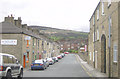
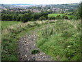
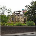
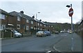
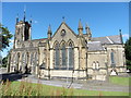
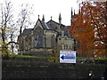
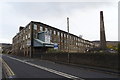
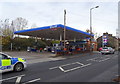
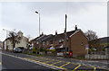
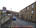

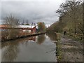
41 photos from this area
Area Information
Key information about the SK15 3EQ including its size, population, and administrative classification.
- Area Type
- Postcode
- Area Size
- 1.7 hectares
- Population
- 1740
- Population Density
- 2661 people/km²
House Prices in SK15 3EQ
48
Properties
£107,032
Average Sold Price
£58,000
Lowest Price
£159,000
Highest Price
Showing 48 properties
| Address | Type | Beds | Baths | Last Sale Price | Last Sale Date | |
|---|---|---|---|---|---|---|
| 47 Harridge Avenue, Stalybridge, SK15 3EQ | Terraced | 2 | 1 | £150,000 | Oct 2024 | |
| 31 Harridge Avenue, Stalybridge, SK15 3EQ | house | - | - | £126,500 | Jun 2024 | |
| 49 Harridge Avenue, Stalybridge, SK15 3EQ | Terraced | 2 | 1 | £159,000 | Sep 2023 | |
| 21 Harridge Avenue, Stalybridge, SK15 3EQ | house | 3 | - | £110,000 | Oct 2021 | |
| 5 Harridge Avenue, Stalybridge, SK15 3EQ | house | - | - | £117,000 | Feb 2021 | |
| 53 Harridge Avenue, Stalybridge, SK15 3EQ | Terraced | 2 | 1 | £120,000 | Oct 2020 | |
| 32 Harridge Avenue, Stalybridge, SK15 3EQ | house | - | - | £70,000 | Oct 2018 | |
| 39 Harridge Avenue, Stalybridge, SK15 3EQ | Semi-detached | 3 | 1 | £122,500 | Jul 2017 | |
| 26 Harridge Avenue, Stalybridge, SK15 3EQ | Terraced | 2 | 1 | £88,000 | Jul 2009 | |
| 16 Harridge Avenue, Stalybridge, SK15 3EQ | house | 3 | - | £103,500 | Nov 2007 |
Page 1 of 5
Energy Efficiency in SK15 3EQ
Amenities
Schools
| Rank | School | Type | Entry gender | Ages |
|---|
Explore more schools in this area
Go to Schools tabDemographics
Household Size
Family (3-5 people)
most common
Accommodation Type
Houses
most common
Tenure
52
majority
Ethnic Group
White
most common
Religion
N/A
most common
Household Composition
N/A
most common
Age
47
median
Adults (30-64 years)
most common
Household Deprivation
N/A
with no deprivation
NS-SEC
24
in Lower managerial occupations
Explore more demographic insights in this area
Go to Demographics tabPlanning
Planning Constraints
- Flood RiskPremium
- Ramsar Wetland SitesPremium
- Area of Outstanding Natural BeautyPremium
- Protected Nature ReservePremium
- Protected WoodlandPremium