Area Overview for SK15 3DX
Photos of SK15 3DX
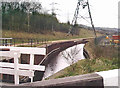
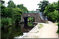
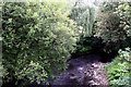
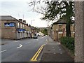
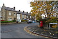
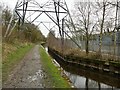
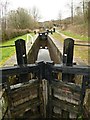
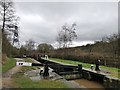
73 photos from this area
Area Information
Key information about the SK15 3DX including its size, population, and administrative classification.
- Area Type
- Postcode
- Area Size
- 5328 m²
- Population
- 1875
- Population Density
- 4805 people/km²
House Prices in SK15 3DX
15
Properties
£109,314
Average Sold Price
£950
Lowest Price
£182,000
Highest Price
Showing 15 properties
| Address | Type | Beds | Baths | Last Sale Price | Last Sale Date | |
|---|---|---|---|---|---|---|
| 8 Tame Close, Stalybridge, SK15 3DX | Terraced | - | - | £950 | Mar 2022 | |
| 6 Tame Close, Stalybridge, SK15 3DX | Semi-detached | 3 | 2 | £158,000 | Feb 2021 | |
| 16 Tame Close, Stalybridge, SK15 3DX | Semi-detached | 4 | 2 | £182,000 | Oct 2018 | |
| 10 Tame Close, Stalybridge, SK15 3DX | house | - | - | £111,000 | May 2018 | |
| 9 Tame Close, Stalybridge, SK15 3DX | Terraced | 3 | 2 | £160,000 | Nov 2016 | |
| 14 Tame Close, Stalybridge, SK15 3DX | Terraced | 3 | 1 | £118,000 | Feb 2016 | |
| 5 Tame Close, Stalybridge, SK15 3DX | house | 3 | 1 | £87,500 | Nov 2013 | |
| 20 Tame Close, Stalybridge, SK15 3DX | house | - | - | £160,000 | Jun 2006 | |
| 1 Tame Close, Stalybridge, SK15 3DX | Terraced | - | - | £115,000 | Jun 2004 | |
| 3 Tame Close, Stalybridge, SK15 3DX | Terraced | - | - | £55,000 | Jul 1998 |
Page 1 of 2
Energy Efficiency in SK15 3DX
Amenities
Schools
| Rank | School | Type | Entry gender | Ages |
|---|
Explore more schools in this area
Go to Schools tabDemographics
Household Size
Family (3-5 people)
most common
Accommodation Type
Houses
most common
Tenure
86
majority
Ethnic Group
White
most common
Religion
N/A
most common
Household Composition
N/A
most common
Age
47
median
Adults (30-64 years)
most common
Household Deprivation
N/A
with no deprivation
NS-SEC
36
in Lower managerial occupations
Explore more demographic insights in this area
Go to Demographics tabPlanning
Planning Constraints
- Flood RiskPremium
- Ramsar Wetland SitesPremium
- Area of Outstanding Natural BeautyPremium
- Protected Nature ReservePremium
- Protected WoodlandPremium