Area Overview for SK15 2PG
Photos of SK15 2PG
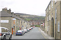
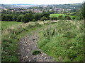
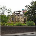
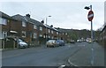


41 photos from this area
Area Information
Key information about the SK15 2PG including its size, population, and administrative classification.
- Area Type
- Postcode
- Area Size
- 10.1 hectares
- Population
- 1740
- Population Density
- 2661 people/km²
House Prices in SK15 2PG
45
Properties
£137,375
Average Sold Price
£75,000
Lowest Price
£185,000
Highest Price
Showing 45 properties
| Address | Type | Beds | Baths | Last Sale Price | Last Sale Date | |
|---|---|---|---|---|---|---|
| 121 Demesne Drive, Stalybridge, SK15 2PG | Terraced | 3 | 1 | £185,000 | Dec 2024 | |
| 57 Demesne Drive, Stalybridge, SK15 2PG | Semi-detached | 3 | - | £185,000 | Oct 2024 | |
| 55 Demesne Drive, Stalybridge, SK15 2PG | Semi-detached | 3 | 1 | £170,000 | Apr 2024 | |
| 127 Demesne Drive, Stalybridge, SK15 2PG | Semi-detached | 3 | - | £139,000 | Jun 2021 | |
| 59 Demesne Drive, Stalybridge, SK15 2PG | Detached | 3 | 3 | £158,000 | Jun 2020 | |
| 117 Demesne Drive, Stalybridge, SK15 2PG | Semi-detached | 3 | 1 | £90,000 | Oct 2015 | |
| 133 Demesne Drive, Stalybridge, SK15 2PG | Semi-detached | 3 | 1 | £75,000 | May 2014 | |
| 119 Demesne Drive, Stalybridge, SK15 2PG | Terraced | - | - | £97,000 | Jun 2005 | |
| 83 Demesne Drive, Stalybridge, SK15 2PG | Flat | - | - | - | - | |
| 79 Demesne Drive, Stalybridge, SK15 2PG | Flat | - | - | - | - |
Page 1 of 5
Energy Efficiency in SK15 2PG
Amenities
Schools
| Rank | School | Type | Entry gender | Ages |
|---|
Explore more schools in this area
Go to Schools tabDemographics
Household Size
Family (3-5 people)
most common
Accommodation Type
Houses
most common
Tenure
52
majority
Ethnic Group
White
most common
Religion
N/A
most common
Household Composition
N/A
most common
Age
47
median
Adults (30-64 years)
most common
Household Deprivation
N/A
with no deprivation
NS-SEC
24
in Lower managerial occupations
Explore more demographic insights in this area
Go to Demographics tabPlanning
Planning Constraints
- Flood RiskPremium
- Ramsar Wetland SitesPremium
- Area of Outstanding Natural BeautyPremium
- Protected Nature ReservePremium
- Protected WoodlandPremium