Area Overview for SK15 1NJ
Photos of SK15 1NJ
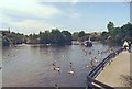
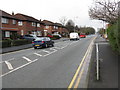
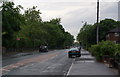
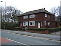
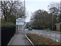
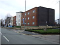
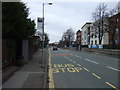
90 photos from this area
Area Information
Key information about the SK15 1NJ including its size, population, and administrative classification.
- Area Type
- Postcode
- Area Size
- 5.6 hectares
- Population
- 1415
- Population Density
- 4263 people/km²
House Prices in SK15 1NJ
29
Properties
£312,250
Average Sold Price
£116,000
Lowest Price
£615,000
Highest Price
Showing 29 properties
| Address | Type | Beds | Baths | Last Sale Price | Last Sale Date | |
|---|---|---|---|---|---|---|
| Laurel Bank, 30 Astley Road, Stalybridge, SK15 1NJ | house | - | - | £615,000 | Mar 2022 | |
| Garcliffe, 34 Astley Road, Stalybridge, SK15 1NJ | Detached | 5 | 2 | £347,500 | May 2020 | |
| Braemar, 36 Astley Road, Stalybridge, SK15 1NJ | Detached | 5 | 3 | £370,000 | Jun 2017 | |
| 38 Astley Road, Stalybridge, SK15 1NJ | house | 4 | - | £250,000 | Jun 2011 | |
| Cranford, 32 Astley Road, Stalybridge, SK15 1NJ | Detached | - | - | £175,000 | Feb 2009 | |
| 28 Astley Road, Stalybridge, SK15 1NJ | Detached | - | - | £116,000 | Mar 1996 | |
| 16 Astley Road, Stalybridge, SK15 1NJ | Semi-detached | 5 | 2 | - | - | |
| Westbrook Childrens Home, Astley Road, Stalybridge, SK15 1NJ | undefined | - | - | - | - | |
| Flat 9, 20 Astley Road, Stalybridge, SK15 1NJ | undefined | - | - | - | - | |
| Flat 10, 20 Astley Road, Stalybridge, SK15 1NJ | undefined | - | - | - | - |
Page 1 of 3
Energy Efficiency in SK15 1NJ
Amenities
Schools
| Rank | School | Type | Entry gender | Ages |
|---|
Explore more schools in this area
Go to Schools tabDemographics
Household Size
Two person
most common
Accommodation Type
Houses
most common
Tenure
58
majority
Ethnic Group
White
most common
Religion
N/A
most common
Household Composition
N/A
most common
Age
47
median
Adults (30-64 years)
most common
Household Deprivation
N/A
with no deprivation
NS-SEC
24
in Lower managerial occupations
Explore more demographic insights in this area
Go to Demographics tabPlanning
Planning Constraints
- Flood RiskPremium
- Ramsar Wetland SitesPremium
- Area of Outstanding Natural BeautyPremium
- Protected Nature ReservePremium
- Protected WoodlandPremium