Area Overview for SK15 1BE
Photos of SK15 1BE
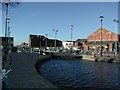
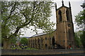
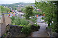
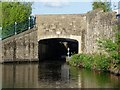
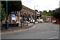
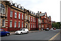
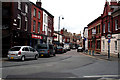
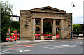
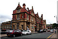
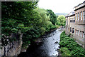
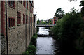
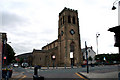
100 photos from this area
Area Information
Key information about the SK15 1BE including its size, population, and administrative classification.
- Area Type
- Postcode
- Area Size
- 6820 m²
- Population
- 1510
- Population Density
- 3674 people/km²
House Prices in SK15 1BE
28
Properties
£101,078
Average Sold Price
£37,000
Lowest Price
£170,000
Highest Price
Showing 28 properties
| Address | Type | Beds | Baths | Last Sale Price | Last Sale Date | |
|---|---|---|---|---|---|---|
| 3 Church Street, Stalybridge, SK15 1BE | Semi-detached | 3 | 1 | £170,000 | Jan 2024 | |
| 26 Church Street, Stalybridge, SK15 1BE | house | 3 | 1 | £167,000 | Mar 2023 | |
| 45 Church Street, Stalybridge, SK15 1BE | Flat | 1 | 1 | £104,250 | Feb 2020 | |
| 48 Church Street, Stalybridge, SK15 1BE | house | - | - | £120,000 | May 2019 | |
| 10 Church Street, Stalybridge, SK15 1BE | Terraced | 3 | 1 | £110,000 | Aug 2010 | |
| 4 Church Street, Stalybridge, SK15 1BE | house | 3 | 1 | £137,000 | Mar 2007 | |
| 9 Church Street, Stalybridge, SK15 1BE | Terraced | - | - | £124,000 | Feb 2007 | |
| 28 Church Street, Stalybridge, SK15 1BE | house | 3 | - | £124,950 | Aug 2006 | |
| 16 Church Street, Stalybridge, SK15 1BE | Terraced | - | - | £119,000 | Aug 2006 | |
| 46 Church Street, Stalybridge, SK15 1BE | house | - | - | £116,500 | May 2006 |
Page 1 of 3
Energy Efficiency in SK15 1BE
Amenities
Schools
| Rank | School | Type | Entry gender | Ages |
|---|
Explore more schools in this area
Go to Schools tabDemographics
Household Size
One person
most common
Accommodation Type
Houses
most common
Tenure
39
majority
Ethnic Group
White
most common
Religion
N/A
most common
Household Composition
N/A
most common
Age
47
median
Adults (30-64 years)
most common
Household Deprivation
N/A
with no deprivation
NS-SEC
22
in Lower managerial occupations
Explore more demographic insights in this area
Go to Demographics tabPlanning
Planning Constraints
- Flood RiskPremium
- Ramsar Wetland SitesPremium
- Area of Outstanding Natural BeautyPremium
- Protected Nature ReservePremium
- Protected WoodlandPremium