Area Overview for SK14 5PG
Photos of SK14 5PG
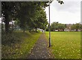
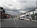
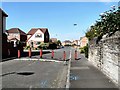
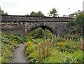
100 photos from this area
Area Information
Key information about the SK14 5PG including its size, population, and administrative classification.
- Area Type
- Postcode
- Area Size
- 1.3 hectares
- Population
- 1776
- Population Density
- 4547 people/km²
House Prices in SK14 5PG
28
Properties
£98,208
Average Sold Price
£37,000
Lowest Price
£130,000
Highest Price
Showing 28 properties
| Address | Type | Beds | Baths | Last Sale Price | Last Sale Date | |
|---|---|---|---|---|---|---|
| 48 Mansfield Road, Hyde, SK14 5PG | house | 2 | 1 | £115,000 | Oct 2020 | |
| 36 Mansfield Road, Hyde, SK14 5PG | Semi-detached | 2 | 1 | £130,000 | May 2019 | |
| 41 Mansfield Road, Hyde, SK14 5PG | house | 3 | 1 | £113,000 | Oct 2018 | |
| 52 Mansfield Road, Hyde, SK14 5PG | Detached | 3 | 1 | £125,000 | Aug 2016 | |
| 55 Mansfield Road, Hyde, SK14 5PG | Semi-detached | 2 | - | £112,000 | Sep 2014 | |
| 42 Mansfield Road, Hyde, SK14 5PG | house | - | - | £95,000 | Dec 2013 | |
| 43 Mansfield Road, Hyde, SK14 5PG | Semi-detached | 3 | 1 | £78,500 | Oct 2012 | |
| 56 Mansfield Road, Hyde, SK14 5PG | house | 3 | - | £112,500 | Jan 2012 | |
| 30 Mansfield Road, Hyde, SK14 5PG | house | - | - | £105,000 | Jun 2006 | |
| 40 Mansfield Road, Hyde, SK14 5PG | house | - | - | £92,000 | Feb 2006 |
Page 1 of 3
Energy Efficiency in SK14 5PG
Amenities
Schools
| Rank | School | Type | Entry gender | Ages |
|---|
Explore more schools in this area
Go to Schools tabDemographics
Household Size
One person
most common
Accommodation Type
Houses
most common
Tenure
34
majority
Ethnic Group
White
most common
Religion
N/A
most common
Household Composition
N/A
most common
Age
47
median
Adults (30-64 years)
most common
Household Deprivation
N/A
with no deprivation
NS-SEC
16
in Lower managerial occupations
Explore more demographic insights in this area
Go to Demographics tabPlanning
Planning Constraints
- Flood RiskPremium
- Ramsar Wetland SitesPremium
- Area of Outstanding Natural BeautyPremium
- Protected Nature ReservePremium
- Protected WoodlandPremium