Area Overview for SK14 4RF
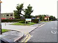
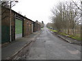
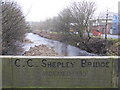
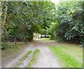
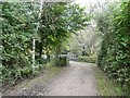
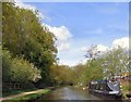
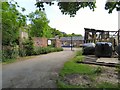
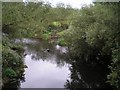
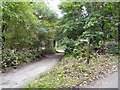
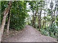
Photos of SK14 4RF


Area Information
Living in SK14 4RF means occupying a very specific residential cluster defined by the postcode itself. This area covers a total size of 2846 m², which houses a population of 2255 people. The result is a densely populated neighbourhood where residents experience close proximity to one another within a compact footprint. You will find yourself in a community characterised by high occupancy rates rather than sprawling suburban streets. The sheer concentration of people in such a small geographical space creates an immediate sense of being at the heart of activity. This postcode covers a specific residential cluster typical of the Greater Manchester landscape. Daily life is shaped by this density, which limits large public green spaces within the immediate cluster but ensures no resident is far from their neighbours. The environment is strictly urban in nature. If you are considering homes in SK14 4RF, you are entering a territory defined by its tight boundaries and high population concentration. The area does not offer extensive rural elements or large private plots. Instead, it provides a contained living experience typical of established urban districts. You move through an environment where the built fabric dominates the landscape. This compactness dictates the rhythm of day-to-day routines.
- Area Type
- Postcode
- Area Size
- 2846 m²
- Population
- 2255
- Population Density
- 2762 people/km²
The property market in SK14 4RF is defined by a predominantly owner-occupied tenure structure. Currently, 53% of households in this postcode hold their properties freehold or through mortgage ownership. This figure suggests a community where long-term residents have settled and built equity. The remaining 47% comprises the private rented sector. Given the accommodation type is listed as Houses, the housing stock consists of detached, semi-detached, or terraced family dwellings rather than flats. This distinction is vital for buyers accustomed to apartment living. The high concentration of houses supports families requiring multiple bedrooms and private outdoor space. As a small postcode covering 2846 m², the supply of individual properties is limited. Competition for available homes will be fierce if specific properties come to market. Buyers looking at SK14 4RF should expect a mature market where sale prices reflect the desire for established housing stock. The lack of flats makes this area unsuitable for those seeking higher-density urban living. Conversely, it offers the conventional British home environment for those prioritising space. The 53% ownership rate implies that many current owners are either depreciating assets or preparing to sell. If you are purchasing a house in this area, you are entering a market where the bulk of the interaction is with owners looking to upgrade or downsize. This dynamic often results in motivated sellers, though the inventory remains thin.
House Prices in SK14 4RF
Showing 1 properties
| Address | Type | Beds | Baths | Last Sale Price | Last Sale Date | |
|---|---|---|---|---|---|---|
| Newland Engineering Co Ltd, Captain Clarke Road, Hyde, SK14 4RF | general_industrial | - | - | - | - |
Energy Efficiency in SK14 4RF
Daily life for you in SK14 4RF is serviced by a practical array of amenities within practical reach. For grocery shopping, Morrisons Daily, Aldi Godley, and Iceland Hyde are all listed as notable retail venues. You can access fresh food and essentials without travelling long distances. Transport links are robust, with five railway stations nearby including Hyde North, Flowery Field, and Hyde Central. These stations connect you to wider Manchester and National Rail networks efficiently. Beyond trains, five key Metro bus stops serve the area, specifically Ashton Moss, Audenshaw, and Ashton West. This ensures coverage for journeys that cannot be made by rail. Public bus transport includes the Chorlton Street Coach Station, providing long-distance options if required. The concentration of these hubs makes commuting by public transport a viable strategy for many residents. You do not need a car for every journey, though accessibility advice remains consistent with the principle that transport options are plentiful. The presence of multiple train and bus stations means that isolation is not a factor in your lifestyle. The retail options cover daily necessities effectively. This network of stations and shops creates a convenient sphere around your postcode where daily errands and commutes are manageable.
Amenities
Schools
Education provision for families in SK14 4RF includes Thomas Ashton School located nearby. This institution is classified as a special school. Special schools are designed to educate children with specific learning needs, disabilities, or other complex requirements. While this school serves the local community, it does not function as a primary or secondary general education provider for the average family seeking comprehensive education. The absence of mainstream secondary or primary schools in the immediate vicinity means that most children in the area will attend schools in neighbouring postcodes. Parents considering this location must look beyond the immediate perimeter of SK14 4RF to find standard state Education. The presence of Thomas Ashton School indicates that the local council recognises a need for specialist provision within the catchment. However, it does not provide a complete range of general schooling options directly within the postcode. Families will need to commute for their children's day-to-day education or ensure that the nearest mainstream schools offer suitable transport links. The specific type of school listed suggests a specialised function rather than a general one. If you are looking for a cluster of primary academies or large secondary comprehensive schools, this specific data point does not populate your view. You must verify the catchment areas of schools in adjacent postcodes for your specific needs.
| Rank | School | Type | Entry gender | Ages |
|---|
Explore more schools in this area
Go to Schools tabDemographics
The community in SK14 4RF reflects a mature settlement pattern. The median age for residents is 47 years, with adults aged between 30 and 64 years representing the most common age range. This demographic skew indicates a stable, established population rather than a transient one. Home ownership is significant, with 53% of households owning their properties outright. The remaining cohort comprises tenants, creating a balanced mix of long-term owners and long-term renters. You will primarily find houses as the predominant accommodation type across this postcode. The resident base is racially diverse according to census classifications, with the predominant ethnic group being White. This profile suggests a neighbourhood that has evolved alongside broader societal changes while maintaining structural stability. The presence of so many adults in the 30-64 bracket likely correlates with families raising children or professionals in mid-career stages. With more than half of residents owning their homes, the area enjoys a degree of financial stability and rootedness. Deprivation levels are not statistically provided in the current dataset, so an assessment of economic pressure is impossible based solely on available figures. However, the high home ownership rate generally signals a stronger local economy. The age profile implies that services targeting younger adults or retirees may be less central to the local economy than facilities for working-age families. You are living among a population that values stability and has likely invested heavily in their local surroundings over decades.
Household Size
Accommodation Type
Tenure
Ethnic Group
Religion
Household Composition
Age
Household Deprivation
NS-SEC
Explore more demographic insights in this area
Go to Demographics tabPlanning
Planning Constraints
- Flood RiskPremium
- Ramsar Wetland SitesPremium
- Area of Outstanding Natural BeautyPremium
- Protected Nature ReservePremium
- Protected WoodlandPremium