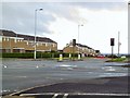
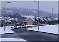
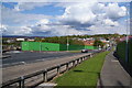
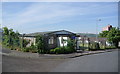
Area Overview for SK14 3JP
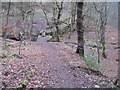
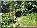
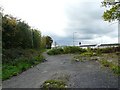
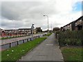
Photos of SK14 3JP


Area Information
SK14 3JP represents a specific postcode cluster in Greater Manchester that serves a small, defined residential population. This area covers precisely 4,496 square metres and homes 1,841 people within its boundaries. The location functions as a concentrated housing cluster rather than a sprawling neighbourhood, creating a close-knit environment where residents navigate daily life. Living in this specific postcode means you occupy a space with a distinct scale, where the physical footprint supports a significant number of inhabitants. The area sits within the broader HL postcode district but maintains its own identity as a tight community. You can expect a setting where the density of people is noticeable yet contained within these specific geographic limits. The mix of housing and the sheer number of residents create a dynamic that differs from larger, less concentrated urban zones. This factual snapshot defines the reality of residing here: a precise location with a known population size and fixed boundaries.
- Area Type
- Postcode
- Area Size
- 4496 m²
- Population
- 1841
- Population Density
- 4175 people/km²
Property in SK14 3JP consists almost entirely of houses, which shapes the expectations for any prospective buyer examining homes in this postcode. With houses dominating the accommodation type, you will not find purpose-built flats or high-rise blocks within these specific boundaries. The low homeownership rate of 30% indicates that while houses are the standard stock, they are frequently occupied by tenants rather than owner-occupiers. This dynamic often characterises areas where rental demand remains high alongside available housing stock. When viewing properties, you are entering a market where the fundamental unit is the house, yet financial structures for ownership differ from more established estate areas. The nature of the housing stock means that renovations or extensions to existing houses are more likely than building new apartment blocks. For someone looking to move into a house here, the inventory is clear and concentrated. The market behaviour suggests a balance between rental investment opportunities and the occasional sale of a home, driven by the large population relative to the small land area.
House Prices in SK14 3JP
Showing 6 properties
| Address | Type | Beds | Baths | Last Sale Price | Last Sale Date | |
|---|---|---|---|---|---|---|
| 4 St Barnabas Close, Hyde, SK14 3JP | house | - | - | - | - | |
| 1 St Barnabas Close, Hyde, SK14 3JP | house | - | - | - | - | |
| 6 St Barnabas Close, Hyde, SK14 3JP | house | - | - | - | - | |
| 2 St Barnabas Close, Hyde, SK14 3JP | house | - | - | - | - | |
| 5 St Barnabas Close, Hyde, SK14 3JP | house | - | - | - | - | |
| 3 St Barnabas Close, Hyde, SK14 3JP | house | - | - | - | - |
Energy Efficiency in SK14 3JP
Your lifestyle in SK14 3JP is defined by convenient access to a variety of practical amenities located within practical reach. For your grocery shopping needs, you have five retail options including Tesco Hattersley, Co-op Hyde, and Tesco Gee Cross. These Tesco locations provide ample choice for weekly shop, offering both hypermarket convenience and smaller grocery formats. Transport links are equally well developed, with five rail stations at your disposal, specifically Hattersley Railway Station, Broadbottom Railway Station, and Godley Railway Station. For those wishing to access the wider Metro network, five key interchange points serve the area, including Ashton West, Ashton Moss, and Audenshaw. These stations allow you to travel efficiently to Greater Manchester and beyond. The combination of major supermarkets and multiple railway and metro hubs means you do not need to travel far for essentials or commuting. Daily life here revolves around these accessible services, ensuring convenience is a constant feature of your routine.
Amenities
Schools
Families considering SK14 3JP can access education through several nearby institutions, specifically Hurstclough Primary School which serves the primary education sector. This school provides the first stage of formal schooling for children living in the vicinity of the postcode. While the data does not list secondary schools, the presence of a primary school indicates that early education is within practical reach without long commutes to other towns. The mix of school types available nearby influences where parents choose to live, as proximity to Hurstclough Primary School is a concrete advantage for those with primary school-aged children. You cannot assume access to specific grammar or specialized secondary institutions without further research outside the provided list, but the primary infrastructure is firmly in place. Choosing a home here guarantees your children can attend Hurstclough Primary School, simplifying the school run and offering local education to the residents of this specific cluster.
| Rank | School | Type | Entry gender | Ages |
|---|
Explore more schools in this area
Go to Schools tabDemographics
The community within SK14 3JP is defined by an older demographic profile with a median age of 47 years. Adults between the ages of 30 and 64 years form the most common age range, indicating that the neighbourhood attracts mature buyers or long-term residents rather than families with young children or young professionals. Homeownership accounts for 30% of residents, which suggests a significant proportion of the occupants are likely tenants renting their properties. The area predominantly features houses as the main type of accommodation, meaning you will find detached, semi-detached, or terraced homes rather than flats or apartments. The predominant ethnic group is White, reflecting the traditional cultural makeup of many parts of Tameside and Greater Manchester. These figures paint a picture of a settled area where stability is common, but the lower ownership rate means rental turnover may be visible. You are looking at a community where the population leans towards middle-aged adults living in houses, with more than a third not owning their freehold.
Household Size
Accommodation Type
Tenure
Ethnic Group
Religion
Household Composition
Age
Household Deprivation
NS-SEC
Explore more demographic insights in this area
Go to Demographics tabPlanning
Planning Constraints
- Flood RiskPremium
- Ramsar Wetland SitesPremium
- Area of Outstanding Natural BeautyPremium
- Protected Nature ReservePremium
- Protected WoodlandPremium