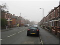
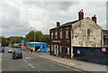
Area Overview for SK14 2NA
Photos of SK14 2NA


Area Information
SK14 2NA is a specific postcode area covering a small residential cluster within Greater Manchester. This location encompasses 1044 square metres of property and land. The population residing in this specific cluster stands at 1776 people. Living in SK14 2NA means being part of a tightly defined neighbourhood where residents share a distinct local identity. You find yourself in a setting defined by its compact scale yet significant population density. The area functions as a concentrated hub for households seeking a defined address within the broader gritside region. Daily life here revolves around the practicalities of shared services and local infrastructure. The small footprint means you are neighbours with a significant number of fellow residents. This creates a community where local issues and amenities are immediately visible. Prospective buyers looking at this postcode are entering a space where geography plays a major role in daily convenience. The area serves as a functional residential zone with clear boundaries and a resident base that supports local trade and services.
- Area Type
- Postcode
- Area Size
- 1044 m²
- Population
- 1776
- Population Density
- 4547 people/km²
Homes in SK14 2NA are primarily houses, which defines the physical character of the street scene. The proportion of households that own their property stands at exactly 34 per cent. This statistic indicates that the majority of residents in this postcode rent their accommodation rather than own it free and clear. You are entering a market where tenure is split almost evenly between ownership and rental agreements. The prevalence of houses over other property types suggests larger living spaces relative to typical urban flats. This housing stock appeals to buyers seeking traditional residential layouts. For investors or renters, the 34 per cent ownership rate signals a competitive rental sector with significant local demand. The accommodation type dictates the architectural style and garden space available to you. When viewing properties here, expect a footprint dominated by detached or semi-detached family homes. The market reflects the needs of a population that values house-sized accommodation.
House Prices in SK14 2NA
No properties found in this postcode.
Energy Efficiency in SK14 2NA
Residents benefits from a practical range of retail and transport options just outside SK14 2NA. You can shop at Farmfoods Godley, Morrisons Godley, and Asda Hyde, covering three distinct grocery and retail needs. Five stations serve train travel for those seeking rail transport, including Hyde Central, Newton for Hyde, and Flowery Field stations. Public metro access is also available via Audenshaw, Ashton Moss, and Ashton West stops. These facilities extend your daily reach beyond the immediate residential streets. You will not need to drive extensively to access daily necessities or commute. The variety of railway and metro hubs means flexibility in your travel plans. Supermarkets on nearby Highways allow for routine errands to be completed quickly. These amenities create a convenient buffer between home and the wider city services.
Amenities
Schools
Families living in SK14 2NA have access to a specific network of educational institutions nearby. Leigh Primary School operates in the area as a primary institution. You will also find Leigh Street Junior School providing education for younger children in this catchment. Additionally, Leigh Street Infant School serves the early years stage of primary education. Arnfield Independent School holds a special school category and has received a good Ofsted rating, offering specialist education. Endeavour Primary Academy is another primary option available for families within reach. This mix of primary and special needs provision allows parents to choose settings tailored to their children's requirements. The presence of schools with good ratings suggests a commitment to educational standards in the local vicinity. Prospective homebuyers will appreciate the immediate access to these named learning environments without needing to travel further for education.
| Rank | School | Type | Entry gender | Ages |
|---|
Explore more schools in this area
Go to Schools tabDemographics
The community of SK14 2NA is predominantly composed of adults aged 30 to 64 years. The median age across the area is 47 years, indicating a mature population base. Houses are the primary accommodation type found in this postcode. Home ownership stands at 34 per cent, meaning a notable portion of the population rents their accommodation. White residents form the predominant ethnic group within this cluster. The demographic profile suggests an area where families and grown professionals live alongside those in later life stages. This age structure influences the type of services and social activities available to you. With over a third of residents renting, the area maintains a mix of owner-occupiers and tenants. The high median age points towards stability and established long-term residency patterns. You should expect a neighbourhood where decisions are often made with consideration for older age groups and dependent children alike. The residential character is shaped by these specific age and ownership dynamics.
Household Size
Accommodation Type
Tenure
Ethnic Group
Religion
Household Composition
Age
Household Deprivation
NS-SEC
Explore more demographic insights in this area
Go to Demographics tabPlanning
Planning Constraints
- Flood RiskPremium
- Ramsar Wetland SitesPremium
- Area of Outstanding Natural BeautyPremium
- Protected Nature ReservePremium
- Protected WoodlandPremium