Area Overview for SK14 2HB
Photos of SK14 2HB
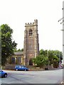
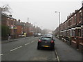
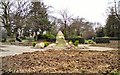
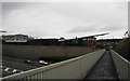
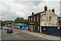
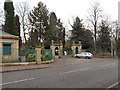
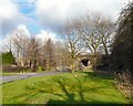
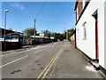
100 photos from this area
Area Information
Key information about the SK14 2HB including its size, population, and administrative classification.
- Area Type
- Postcode
- Area Size
- 3.0 hectares
- Population
- 2147
- Population Density
- 3209 people/km²
House Prices in SK14 2HB
13
Properties
£49,522
Average Sold Price
£650
Lowest Price
£85,000
Highest Price
Showing 13 properties
| Address | Type | Beds | Baths | Last Sale Price | Last Sale Date | |
|---|---|---|---|---|---|---|
| 86 John Street, Hyde, SK14 2HB | Terraced | 2 | 1 | £85,000 | Mar 2020 | |
| 76 John Street, Hyde, SK14 2HB | Terraced | - | - | £61,300 | Jun 2018 | |
| 88 John Street, Hyde, SK14 2HB | Terraced | - | - | £650 | Dec 2016 | |
| 75 John Street, Hyde, SK14 2HB | Office | 2 | - | £71,000 | Dec 2014 | |
| 82 John Street, Hyde, SK14 2HB | Terraced | - | - | £50,000 | Oct 2003 | |
| 80 John Street, Hyde, SK14 2HB | Terraced | - | - | £29,180 | Sep 1999 | |
| Drive City Cars Ltd, John Street, Hyde, SK14 2HB | shop | - | - | - | - | |
| Unit 2 -mjm Contract Services Ltd - 1ST Floor, Lotus House, 77 John Street, Hyde, SK14 2HB | Office | - | - | - | - | |
| Unit 3 - Mjm Contract Services Ltd - 1ST Floor Lotus House, Lotus House, 77 John Street, Hyde, SK14 2HB | Office | - | - | - | - | |
| Mjm Contract Services Ltd - Ground Floor, Lotus House, 77 John Street, Hyde, SK14 2HB | Office | - | - | - | - |
Page 1 of 2
Energy Efficiency in SK14 2HB
Amenities
Schools
| Rank | School | Type | Entry gender | Ages |
|---|
Explore more schools in this area
Go to Schools tabDemographics
Household Size
One person
most common
Accommodation Type
Houses
most common
Tenure
56
majority
Ethnic Group
White
most common
Religion
N/A
most common
Household Composition
N/A
most common
Age
47
median
Adults (30-64 years)
most common
Household Deprivation
N/A
with no deprivation
NS-SEC
27
in Lower managerial occupations
Explore more demographic insights in this area
Go to Demographics tabPlanning
Planning Constraints
- Flood RiskPremium
- Ramsar Wetland SitesPremium
- Area of Outstanding Natural BeautyPremium
- Protected Nature ReservePremium
- Protected WoodlandPremium