Area Overview for SK12 2BS
Photos of SK12 2BS
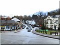
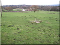
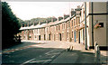
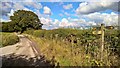
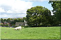
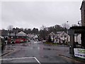
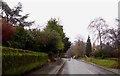
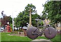
76 photos from this area
Area Information
Key information about the SK12 2BS including its size, population, and administrative classification.
- Area Type
- Postcode
- Area Size
- 1.5 hectares
- Population
- 1372
- Population Density
- 1982 people/km²
House Prices in SK12 2BS
26
Properties
£200,292
Average Sold Price
£116,000
Lowest Price
£285,000
Highest Price
Showing 26 properties
| Address | Type | Beds | Baths | Last Sale Price | Last Sale Date | |
|---|---|---|---|---|---|---|
| 6 Royal Road, Disley, SK12 2BS | Semi-detached | 3 | 1 | £280,000 | May 2024 | |
| 18 Royal Road, Disley, SK12 2BS | Semi-detached | 2 | 1 | £264,950 | Mar 2024 | |
| 13 Royal Road, Disley, SK12 2BS | Semi-detached | 3 | 1 | £277,000 | Nov 2023 | |
| 9 Royal Road, Disley, SK12 2BS | Semi-detached | 2 | - | £285,000 | Feb 2023 | |
| 16 Royal Road, Disley, SK12 2BS | house | - | - | £207,900 | Apr 2021 | |
| 8 Royal Road, Disley, SK12 2BS | house | - | - | £189,950 | Sep 2020 | |
| 21 Royal Road, Disley, SK12 2BS | house | - | - | £215,000 | Aug 2020 | |
| 17 Royal Road, Disley, SK12 2BS | house | - | - | £175,000 | Jan 2019 | |
| 23 Royal Road, Disley, SK12 2BS | house | - | - | £149,000 | Feb 2013 | |
| 15 Royal Road, Disley, SK12 2BS | Semi-detached | 2 | 1 | £143,000 | Jul 2012 |
Page 1 of 3
Energy Efficiency in SK12 2BS
Amenities
Schools
| Rank | School | Type | Entry gender | Ages |
|---|
Explore more schools in this area
Go to Schools tabDemographics
Household Size
Two person
most common
Accommodation Type
Houses
most common
Tenure
76
majority
Ethnic Group
White
most common
Religion
N/A
most common
Household Composition
N/A
most common
Age
47
median
Adults (30-64 years)
most common
Household Deprivation
N/A
with no deprivation
NS-SEC
46
in Lower managerial occupations
Explore more demographic insights in this area
Go to Demographics tabPlanning
Planning Constraints
- Flood RiskPremium
- Ramsar Wetland SitesPremium
- Area of Outstanding Natural BeautyPremium
- Protected Nature ReservePremium
- Protected WoodlandPremium