Area Overview for SK12 1PT
Photos of SK12 1PT
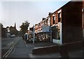
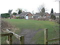
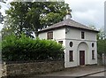
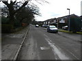


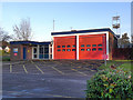
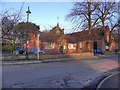
31 photos from this area
Area Information
Key information about the SK12 1PT including its size, population, and administrative classification.
- Area Type
- Postcode
- Area Size
- 1.7 hectares
- Population
- 2459
- Population Density
- 2489 people/km²
House Prices in SK12 1PT
32
Properties
£306,084
Average Sold Price
£144,200
Lowest Price
£550,057
Highest Price
Showing 32 properties
| Address | Type | Beds | Baths | Last Sale Price | Last Sale Date | |
|---|---|---|---|---|---|---|
| 16 Yew Tree Lane, Poynton, SK12 1PT | Semi-detached | 3 | 1 | £335,000 | Feb 2025 | |
| 22 Yew Tree Lane, Poynton, SK12 1PT | Semi-detached | 3 | 1 | £396,000 | Sep 2024 | |
| 36 Yew Tree Lane, Poynton, SK12 1PT | Semi-detached | 2 | 1 | £368,000 | Jun 2023 | |
| 57 Yew Tree Lane, Poynton, SK12 1PT | Detached | 4 | 1 | £550,057 | Mar 2023 | |
| 24 Yew Tree Lane, Poynton, SK12 1PT | Bungalow | - | - | £375,000 | Aug 2019 | |
| 38 Yew Tree Lane, Poynton, SK12 1PT | Bungalow | - | - | £320,000 | Apr 2018 | |
| 12 Yew Tree Lane, Poynton, SK12 1PT | Detached | 3 | 2 | £365,000 | Nov 2017 | |
| 28 Yew Tree Lane, Poynton, SK12 1PT | Bungalow | - | - | £265,000 | Aug 2016 | |
| 39 Yew Tree Lane, Poynton, SK12 1PT | house | - | - | £370,000 | Jul 2015 | |
| 40 Yew Tree Lane, Poynton, SK12 1PT | Bungalow | - | - | £290,000 | Jun 2015 |
Page 1 of 4
Energy Efficiency in SK12 1PT
Amenities
Schools
| Rank | School | Type | Entry gender | Ages |
|---|
Explore more schools in this area
Go to Schools tabDemographics
Household Size
Two person
most common
Accommodation Type
Houses
most common
Tenure
91
majority
Ethnic Group
White
most common
Religion
N/A
most common
Household Composition
N/A
most common
Age
47
median
Adults (30-64 years)
most common
Household Deprivation
N/A
with no deprivation
NS-SEC
46
in Lower managerial occupations
Explore more demographic insights in this area
Go to Demographics tabPlanning
Planning Constraints
- Flood RiskPremium
- Ramsar Wetland SitesPremium
- Area of Outstanding Natural BeautyPremium
- Protected Nature ReservePremium
- Protected WoodlandPremium