Area Overview for SK11 8SR
Photos of SK11 8SR
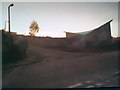
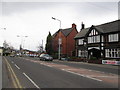
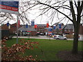


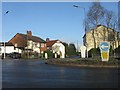
19 photos from this area
Area Information
Key information about the SK11 8SR including its size, population, and administrative classification.
- Area Type
- Postcode
- Area Size
- 3.4 hectares
- Population
- 1521
- Population Density
- 3635 people/km²
House Prices in SK11 8SR
56
Properties
£138,106
Average Sold Price
£41,500
Lowest Price
£275,000
Highest Price
Showing 56 properties
| Address | Type | Beds | Baths | Last Sale Price | Last Sale Date | |
|---|---|---|---|---|---|---|
| 121 Earlsway, Macclesfield, SK11 8SR | Terraced | 3 | 1 | £275,000 | Sep 2025 | |
| 119 Earlsway, Macclesfield, SK11 8SR | house | - | - | £185,000 | Mar 2021 | |
| 94 Earlsway, Macclesfield, SK11 8SR | Bungalow | - | - | £163,760 | Mar 2021 | |
| 98 Earlsway, Macclesfield, SK11 8SR | house | - | - | £152,500 | Oct 2019 | |
| 117 Earlsway, Macclesfield, SK11 8SR | Terraced | 3 | 1 | £185,000 | Sep 2019 | |
| 89 Earlsway, Macclesfield, SK11 8SR | Terraced | - | - | £154,950 | Feb 2018 | |
| 139 Earlsway, Macclesfield, SK11 8SR | house | 3 | 1 | £185,000 | Jan 2018 | |
| 110 Earlsway, Macclesfield, SK11 8SR | Semi-detached | 3 | - | £160,000 | Mar 2016 | |
| 102 Earlsway, Macclesfield, SK11 8SR | Semi-detached | 3 | - | £150,000 | Sep 2015 | |
| 111 Earlsway, Macclesfield, SK11 8SR | house | - | - | £115,000 | Jun 2014 |
Page 1 of 6
Energy Efficiency in SK11 8SR
Amenities
Schools
| Rank | School | Type | Entry gender | Ages |
|---|
Explore more schools in this area
Go to Schools tabDemographics
Household Size
Family (3-5 people)
most common
Accommodation Type
Houses
most common
Tenure
68
majority
Ethnic Group
White
most common
Religion
N/A
most common
Household Composition
N/A
most common
Age
47
median
Adults (30-64 years)
most common
Household Deprivation
N/A
with no deprivation
NS-SEC
29
in Lower managerial occupations
Explore more demographic insights in this area
Go to Demographics tabPlanning
Planning Constraints
- Flood RiskPremium
- Ramsar Wetland SitesPremium
- Area of Outstanding Natural BeautyPremium
- Protected Nature ReservePremium
- Protected WoodlandPremium