Area Overview for SK11 8LW
Photos of SK11 8LW

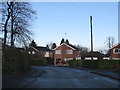
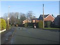
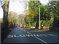
13 photos from this area
Area Information
Key information about the SK11 8LW including its size, population, and administrative classification.
- Area Type
- Postcode
- Area Size
- 3.2 hectares
- Population
- 1729
- Population Density
- 3625 people/km²
House Prices in SK11 8LW
45
Properties
£279,252
Average Sold Price
£78,000
Lowest Price
£505,000
Highest Price
Showing 45 properties
| Address | Type | Beds | Baths | Last Sale Price | Last Sale Date | |
|---|---|---|---|---|---|---|
| 32 Sycamore Crescent, Macclesfield, SK11 8LW | Detached | 4 | 1 | £380,000 | Aug 2025 | |
| 49 Sycamore Crescent, Macclesfield, SK11 8LW | house | - | - | £505,000 | Mar 2025 | |
| 59 Sycamore Crescent, Macclesfield, SK11 8LW | house | - | - | £301,000 | Jun 2021 | |
| 24 Sycamore Crescent, Macclesfield, SK11 8LW | house | - | - | £391,000 | Feb 2021 | |
| 39 Sycamore Crescent, Macclesfield, SK11 8LW | Detached | 4 | 2 | £340,000 | Apr 2018 | |
| 26 Sycamore Crescent, Macclesfield, SK11 8LW | house | - | - | £239,950 | Mar 2018 | |
| 75 Sycamore Crescent, Macclesfield, SK11 8LW | Detached | 5 | 2 | £360,000 | Oct 2016 | |
| 77 Sycamore Crescent, Macclesfield, SK11 8LW | house | - | - | £415,000 | Aug 2016 | |
| 65 Sycamore Crescent, Macclesfield, SK11 8LW | Detached | 3 | - | £297,350 | Sep 2015 | |
| 83 Sycamore Crescent, Macclesfield, SK11 8LW | Detached | - | - | £400,000 | Jul 2015 |
Page 1 of 5
Energy Efficiency in SK11 8LW
Amenities
Schools
| Rank | School | Type | Entry gender | Ages |
|---|
Explore more schools in this area
Go to Schools tabDemographics
Household Size
Two person
most common
Accommodation Type
Houses
most common
Tenure
84
majority
Ethnic Group
White
most common
Religion
N/A
most common
Household Composition
N/A
most common
Age
47
median
Adults (30-64 years)
most common
Household Deprivation
N/A
with no deprivation
NS-SEC
47
in Lower managerial occupations
Explore more demographic insights in this area
Go to Demographics tabPlanning
Planning Constraints
- Flood RiskPremium
- Ramsar Wetland SitesPremium
- Area of Outstanding Natural BeautyPremium
- Protected Nature ReservePremium
- Protected WoodlandPremium