Area Overview for SK11 7UY
Photos of SK11 7UY
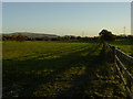
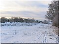
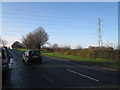
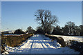

6 photos from this area
Area Information
Key information about the SK11 7UY including its size, population, and administrative classification.
- Area Type
- Postcode
- Area Size
- 6.6 hectares
- Population
- 2368
- Population Density
- 57 people/km²
House Prices in SK11 7UY
39
Properties
£209,188
Average Sold Price
£69,950
Lowest Price
£482,000
Highest Price
Showing 39 properties
| Address | Type | Beds | Baths | Last Sale Price | Last Sale Date | |
|---|---|---|---|---|---|---|
| 14 Hillcrest Road, Gawsworth, SK11 7UY | Bungalow | 2 | 1 | £230,000 | Jan 2025 | |
| 15 Hillcrest Road, Gawsworth, SK11 7UY | Semi-detached | 4 | 4 | £370,000 | Sep 2024 | |
| 10 Hillcrest Road, Gawsworth, SK11 7UY | Detached | 2 | 1 | £188,000 | May 2024 | |
| 43 Hillcrest Road, Gawsworth, SK11 7UY | house | 3 | 1 | £370,000 | Jan 2023 | |
| Meadow View, 45 Hillcrest Road, Gawsworth, SK11 7UY | Retail | 4 | 2 | £482,000 | May 2022 | |
| 17 Hillcrest Road, Gawsworth, SK11 7UY | house | - | - | £275,000 | Apr 2022 | |
| 20 Hillcrest Road, Gawsworth, SK11 7UY | Semi-detached | - | - | £220,000 | Sep 2020 | |
| 19 Hillcrest Road, Gawsworth, SK11 7UY | house | - | - | £230,000 | Sep 2020 | |
| 28 Hillcrest Road, Gawsworth, SK11 7UY | house | - | - | £250,000 | May 2020 | |
| 32 Hillcrest Road, Gawsworth, SK11 7UY | Detached | 4 | 2 | £315,000 | Apr 2020 |
Page 1 of 4
Energy Efficiency in SK11 7UY
Amenities
Schools
| Rank | School | Type | Entry gender | Ages |
|---|
Explore more schools in this area
Go to Schools tabDemographics
Household Size
Two person
most common
Accommodation Type
Houses
most common
Tenure
86
majority
Ethnic Group
White
most common
Religion
N/A
most common
Household Composition
N/A
most common
Age
47
median
Adults (30-64 years)
most common
Household Deprivation
N/A
with no deprivation
NS-SEC
43
in Lower managerial occupations
Explore more demographic insights in this area
Go to Demographics tabPlanning
Planning Constraints
- Flood RiskPremium
- Ramsar Wetland SitesPremium
- Area of Outstanding Natural BeautyPremium
- Protected Nature ReservePremium
- Protected WoodlandPremium