Area Overview for SK11 7PH
Photos of SK11 7PH
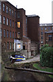
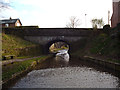
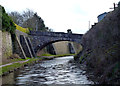
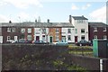
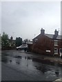
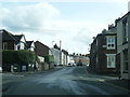
76 photos from this area
Area Information
Key information about the SK11 7PH including its size, population, and administrative classification.
- Area Type
- Postcode
- Area Size
- 1654 m²
- Population
- 1566
- Population Density
- 2626 people/km²
House Prices in SK11 7PH
16
Properties
£773,466
Average Sold Price
£55,000
Lowest Price
£8,826,063
Highest Price
Showing 16 properties
| Address | Type | Beds | Baths | Last Sale Price | Last Sale Date | |
|---|---|---|---|---|---|---|
| 58 Old Mill Lane, Macclesfield, SK11 7PH | Terraced | 2 | 1 | £190,000 | Oct 2025 | |
| 60 Old Mill Lane, Macclesfield, SK11 7PH | Terraced | 3 | 1 | £110,000 | Jul 2022 | |
| 54 Old Mill Lane, Macclesfield, SK11 7PH | Terraced | 4 | 1 | £8,826,063 | Jul 2020 | |
| 76 Old Mill Lane, Macclesfield, SK11 7PH | Terraced | 2 | - | £144,000 | Nov 2019 | |
| 68 Old Mill Lane, Macclesfield, SK11 7PH | Terraced | 5 | - | £117,500 | Mar 2017 | |
| 80 Old Mill Lane, Macclesfield, SK11 7PH | Terraced | 2 | 1 | £86,000 | Oct 2016 | |
| 62 Old Mill Lane, Macclesfield, SK11 7PH | house | - | - | £91,000 | Oct 2015 | |
| 78 Old Mill Lane, Macclesfield, SK11 7PH | house | - | - | £77,500 | Oct 2014 | |
| 56 Old Mill Lane, Macclesfield, SK11 7PH | house | - | - | £88,500 | Mar 2013 | |
| 72 Old Mill Lane, Macclesfield, SK11 7PH | Terraced | - | - | £100,000 | Dec 2008 |
Page 1 of 2
Energy Efficiency in SK11 7PH
Amenities
Schools
| Rank | School | Type | Entry gender | Ages |
|---|
Explore more schools in this area
Go to Schools tabDemographics
Household Size
One person
most common
Accommodation Type
Houses
most common
Tenure
59
majority
Ethnic Group
White
most common
Religion
N/A
most common
Household Composition
N/A
most common
Age
47
median
Adults (30-64 years)
most common
Household Deprivation
N/A
with no deprivation
NS-SEC
42
in Lower managerial occupations
Explore more demographic insights in this area
Go to Demographics tabPlanning
Planning Constraints
- Flood RiskPremium
- Ramsar Wetland SitesPremium
- Area of Outstanding Natural BeautyPremium
- Protected Nature ReservePremium
- Protected WoodlandPremium