Area Overview for SK11 7GA
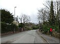
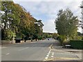
Photos of SK11 7GA


Area Information
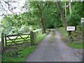
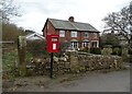
Living in SK11 7GA offers a quiet residential experience within a tightly defined postcode cluster. You will find a community of just over 1,550 residents, situated with a population density of 710 people per square kilometre. This specific area is a small residential cluster rather than a sprawling town centre, providing a sense of seclusion while maintaining access to wider networks. The location sits comfortably within the SK11 postcode region of England, carved out to serve the local housing needs of this neighbourhood. Daily life here is characterised by stability and a focus on domestic comfort. The area functions as a self-contained residential zone where streets are primarily lined with houses designed for long-term occupation. You do not experience the noise or chaos of high-density urban living; instead, the environment prioritises privacy and larger plot sizes typical of the local housing stock. Families and mature individuals often settle in, valuing the tranquil setting that defines this small cluster. If you are considering homes in SK11 7GA, you are entering a market defined by its exclusivity and limited scale. The area does not suffer from the congestion found in larger urban centres. It represents a choice for those seeking a retreat rather than a bustling hub. Your commute will rely on established transport links that connect this pocket of England to broader regional centres. The local character remains distinct, free from the commercial dominance seen in neighbouring towns.
- Area Type
- Postcode
- Area Size
- Not available
- Population
- 1550
- Population Density
- 710 people/km²
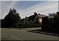
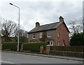
The property market in SK11 7GA is defined by a distinct lack of tenanted housing. With 88% of households classified as owner-occupied, the area operates very differently from mixed markets where rental stocks are common. You are dealing with a community where residents have established roots and financial stakes in the local property. This concentration of ownership typically stabilises property prices and reduces the turnover rate of homes. Homes in SK11 7GA are strictly Houses, adhering to a traditional architectural style suited to the local topography. This uniformity in accommodation type means buyers should expect consistent property sizes and designs without the variance found in areas with a mix of flats and terraced properties. The 1550 population suggests a limited inventory, likely driving up demand for available stock when it does hit the market. For prospective buyers, this implies a competitive environment where few options are available at any given time. The high ownership rate means many sellers may have already renovated or maintained their properties over decades. You are entering a market where the focus is on solid, existing stock rather than new builds or large-scale regeneration projects. The small nature of the residential cluster means that vacant properties might be rare compared to larger towns. If you are looking to purchase, patience may be required as the number of active sales reflects the tight-knit nature of the ownership base.
House Prices in SK11 7GA
No properties found in this postcode.
Energy Efficiency in SK11 7GA
Living in SK11 7GA places you within easy reach of essential retail outlets and transport hubs. You have five notable retail options nearby, including the Co-op Macclesfield, Co-op Hurdsfield, and Aldi Macclesfield. These specific venues satisfy daily shopping needs for groceries and household essentials without requiring a long journey into a major town centre. Residents can complete weekly food runs comfortably within a short drive or walk to these local stores. Transport convenience is another pillar of lifestyle here, with three railway stations serving the immediate vicinity. The proximity to Macclesfield Railway Station, Prestbury Railway Station, and Adlington Railway Station means your commute times are predictable. You can travel to Greater Manchester or Cheshire East without the hassle of navigating local traffic. Additionally, Manchester Woodford Airport is available as a nearer option for air travel, offering flexibility for holidaymakers. This mix of retail and transport creates a balanced routine for those living in the area. You access fresh produce from local supermarkets and head to the station for work seamlessly. The environment supports a self-sufficient daily life where most basic requirements are met within a short radius. Residents do not need to dedicate significant time to commutes for essential errands, allowing more freedom for leisure and family activities.
Amenities
Schools
| Rank | School | Type | Entry gender | Ages |
|---|
Explore more schools in this area
Go to Schools tabDemographics
The community within SK11 7GA is mature, anchored by a median age of 47 years. You are predominantly looking at a population where adults aged between 30 and 64 years form the majority. This age profile suggests a neighbourhood where raising children, managing careers, or enjoying retirement are common life stages. The demographic structure indicates stability, with long-term residents likely to know each other and shape the local culture. Home ownership stands at an impressive 88%, making this a quintessential owner-occupied area. The vast majority of households own their properties outright or with a mortgage, contrasting sharply with rental markets found in other parts of the UK. This high level of ownership contributes to a stable community where investment is viewed as a long-term commitment. Consequently, the local economy relies heavily on disposable income spent within the community rather than on commercial rent. The predominant ethnic group in SK11 7GA is White, reflecting the traditional demographic makeup of many established residential zones in this region. Accommodation type is almost exclusively Houses, meaning you will not find significant numbers of flats or towers within this specific cluster. The built environment caters to families and individuals seeking ground-level living with potential garden space. This preference for houses reinforces the low-density nature of the postcode and the specific lifestyle expectations of buyers searching for homes in this area.
Household Size
Accommodation Type
Tenure
Ethnic Group
Religion
Household Composition
Age
Household Deprivation
NS-SEC
Explore more demographic insights in this area
Go to Demographics tabPlanning
Planning Constraints
- Flood RiskPremium
- Ramsar Wetland SitesPremium
- Area of Outstanding Natural BeautyPremium
- Protected Nature ReservePremium
- Protected WoodlandPremium