Area Overview for SK11 6PR
Photos of SK11 6PR
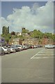
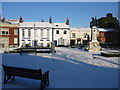
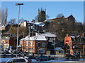
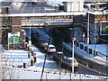


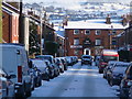
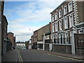
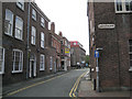
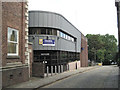
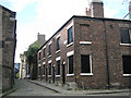
100 photos from this area
Area Information
Key information about the SK11 6PR including its size, population, and administrative classification.
- Area Type
- Postcode
- Area Size
- 5717 m²
- Population
- 1316
- Population Density
- 7114 people/km²
House Prices in SK11 6PR
45
Properties
£138,093
Average Sold Price
£28,500
Lowest Price
£365,000
Highest Price
Showing 45 properties
| Address | Type | Beds | Baths | Last Sale Price | Last Sale Date | |
|---|---|---|---|---|---|---|
| 137 Great King Street, Macclesfield, SK11 6PR | Terraced | 2 | 1 | £170,000 | Dec 2025 | |
| 149 Great King Street, Macclesfield, SK11 6PR | Terraced | 2 | 1 | £177,000 | Sep 2025 | |
| 151 Great King Street, Macclesfield, SK11 6PR | house | - | - | £170,000 | Aug 2025 | |
| 153 Great King Street, Macclesfield, SK11 6PR | Terraced | 2 | 1 | £200,000 | Feb 2025 | |
| 152 Great King Street, Macclesfield, SK11 6PR | Terraced | 3 | 1 | £165,000 | Dec 2024 | |
| 139 Great King Street, Macclesfield, SK11 6PR | Terraced | 2 | 1 | £200,000 | Dec 2023 | |
| 160 Great King Street, Macclesfield, SK11 6PR | Terraced | 2 | 1 | £145,000 | Aug 2023 | |
| 126 Great King Street, Macclesfield, SK11 6PR | Terraced | 2 | - | £250,000 | Mar 2023 | |
| 162 Great King Street, Macclesfield, SK11 6PR | Terraced | 2 | 1 | £141,700 | Nov 2022 | |
| 163 Great King Street, Macclesfield, SK11 6PR | Terraced | 2 | 1 | £232,500 | Jul 2022 |
Page 1 of 5
Energy Efficiency in SK11 6PR
Amenities
Schools
| Rank | School | Type | Entry gender | Ages |
|---|
Explore more schools in this area
Go to Schools tabDemographics
Household Size
One person
most common
Accommodation Type
Houses
most common
Tenure
48
majority
Ethnic Group
White
most common
Religion
N/A
most common
Household Composition
N/A
most common
Age
47
median
Adults (30-64 years)
most common
Household Deprivation
N/A
with no deprivation
NS-SEC
35
in Lower managerial occupations
Explore more demographic insights in this area
Go to Demographics tabPlanning
Planning Constraints
- Flood RiskPremium
- Ramsar Wetland SitesPremium
- Area of Outstanding Natural BeautyPremium
- Protected Nature ReservePremium
- Protected WoodlandPremium