Area Overview for SK11 0BD
Photos of SK11 0BD
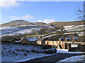
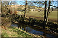
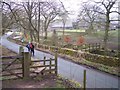
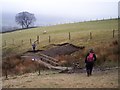
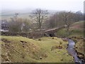
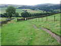
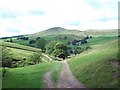
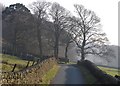
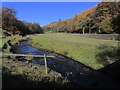
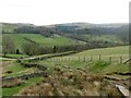
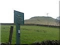
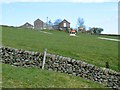
55 photos from this area
Area Information
Key information about the SK11 0BD including its size, population, and administrative classification.
- Area Type
- Postcode
- Area Size
- 4.2 km²
- Population
- 2326
- Population Density
- 35 people/km²
House Prices in SK11 0BD
26
Properties
£519,869
Average Sold Price
£154,000
Lowest Price
£970,000
Highest Price
Showing 26 properties
| Address | Type | Beds | Baths | Last Sale Price | Last Sale Date | |
|---|---|---|---|---|---|---|
| 3, Edinboro Cottages, Clough Road, Wildboarclough, SK11 0BD | house | 3 | 1 | £460,000 | Oct 2022 | |
| The Old Post Office, Crag Hall Lane, Wildboarclough, SK11 0BD | house | - | - | £905,000 | Oct 2021 | |
| Crag Lodge, Crag Hall Lane, Wildboarclough, SK11 0BD | house | - | - | £970,000 | Jul 2019 | |
| Higher Barn Cottage, Clough Road, Wildboarclough, SK11 0BD | Detached | 3 | - | £499,950 | Feb 2017 | |
| 1, Edinboro Cottages, Clough Road, Wildboarclough, SK11 0BD | Terraced | 2 | 1 | £154,000 | Sep 2012 | |
| 2, Edinboro Cottages, Clough Road, Wildboarclough, SK11 0BD | house | 2 | - | £250,000 | Apr 2012 | |
| Rottenstone Cottage, Crag Hall Lane, Wildboarclough, SK11 0BD | Detached | 2 | 1 | £380,000 | Oct 2007 | |
| Old Beams Cottage, Clough Road, Wildboarclough, SK11 0BD | Detached | 4 | - | £540,000 | Nov 2004 | |
| 4, School House, Banking Edge Cottages, Crag Hall Lane, Wildboarclough, SK11 0BD | Detached | 4 | 3 | - | - | |
| Crag Hall, Clough House Lane, Wildboarclough, SK11 0BD | Detached | 3 | 3 | - | - |
Page 1 of 3
Energy Efficiency in SK11 0BD
Amenities
Schools
| Rank | School | Type | Entry gender | Ages |
|---|
Explore more schools in this area
Go to Schools tabDemographics
Household Size
Two person
most common
Accommodation Type
Houses
most common
Tenure
80
majority
Ethnic Group
White
most common
Religion
N/A
most common
Household Composition
N/A
most common
Age
47
median
Adults (30-64 years)
most common
Household Deprivation
N/A
with no deprivation
NS-SEC
45
in Lower managerial occupations
Explore more demographic insights in this area
Go to Demographics tabPlanning
Planning Constraints
- Flood RiskPremium
- Ramsar Wetland SitesPremium
- Area of Outstanding Natural BeautyPremium
- Protected Nature ReservePremium
- Protected WoodlandPremium