Area Overview for SK10 4BR
Photos of SK10 4BR
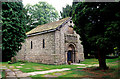
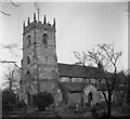
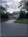
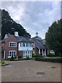
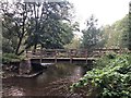
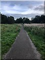
41 photos from this area
Area Information
Key information about the SK10 4BR including its size, population, and administrative classification.
- Area Type
- Postcode
- Area Size
- 1.9 hectares
- Population
- 1804
- Population Density
- 363 people/km²
House Prices in SK10 4BR
11
Properties
£803,214
Average Sold Price
£227,500
Lowest Price
£1,325,000
Highest Price
Showing 11 properties
| Address | Type | Beds | Baths | Last Sale Price | Last Sale Date | |
|---|---|---|---|---|---|---|
| Kinver Cottage, Broad Walk, Prestbury, SK10 4BR | Detached | 5 | 3 | £1,250,000 | Mar 2025 | |
| Brambles, Broad Walk, Prestbury, SK10 4BR | Detached | 4 | 2 | £1,200,000 | Aug 2023 | |
| Forge House, Broad Walk, Prestbury, SK10 4BR | house | 5 | 4 | £1,325,000 | Oct 2017 | |
| Elm Tops, Broad Walk, Prestbury, SK10 4BR | Detached | - | - | £895,000 | Jan 2008 | |
| Grasmere, Broad Walk, Prestbury, SK10 4BR | Detached | - | - | £475,000 | Dec 2001 | |
| Staverton, Broad Walk, Prestbury, SK10 4BR | Detached | - | - | £227,500 | Jun 1997 | |
| Brathay House, Broad Walk, Prestbury, SK10 4BR | Detached | - | - | £250,000 | May 1996 | |
| Crockers Ash, Broad Walk, Prestbury, SK10 4BR | Detached | 5 | 3 | - | - | |
| Thatches, Broad Walk, Prestbury, SK10 4BR | house | - | - | - | - | |
| Kandersteg, Broad Walk, Prestbury, SK10 4BR | Detached | - | - | - | - |
Page 1 of 2
Energy Efficiency in SK10 4BR
Amenities
Schools
| Rank | School | Type | Entry gender | Ages |
|---|
Explore more schools in this area
Go to Schools tabDemographics
Household Size
Two person
most common
Accommodation Type
Houses
most common
Tenure
93
majority
Ethnic Group
White
most common
Religion
N/A
most common
Household Composition
N/A
most common
Age
47
median
Adults (30-64 years)
most common
Household Deprivation
N/A
with no deprivation
NS-SEC
60
in Lower managerial occupations
Explore more demographic insights in this area
Go to Demographics tabPlanning
Planning Constraints
- Flood RiskPremium
- Ramsar Wetland SitesPremium
- Area of Outstanding Natural BeautyPremium
- Protected Nature ReservePremium
- Protected WoodlandPremium