Area Overview for SK10 3BN
Photos of SK10 3BN
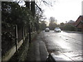
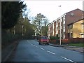
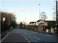
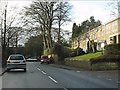
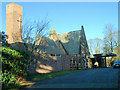
9 photos from this area
Area Information
Key information about the SK10 3BN including its size, population, and administrative classification.
- Area Type
- Postcode
- Area Size
- 2.4 hectares
- Population
- 1535
- Population Density
- 2288 people/km²
House Prices in SK10 3BN
27
Properties
£374,594
Average Sold Price
£94,000
Lowest Price
£660,000
Highest Price
Showing 27 properties
| Address | Type | Beds | Baths | Last Sale Price | Last Sale Date | |
|---|---|---|---|---|---|---|
| 112 Prestbury Road, Macclesfield, SK10 3BN | Semi-detached | 6 | 3 | £640,000 | Nov 2022 | |
| 106 Prestbury Road, Macclesfield, SK10 3BN | house | - | - | £597,000 | Dec 2021 | |
| 102 Prestbury Road, Macclesfield, SK10 3BN | house | - | - | £540,000 | Nov 2017 | |
| 90 Prestbury Road, Macclesfield, SK10 3BN | house | - | - | £370,000 | Nov 2016 | |
| 110 Prestbury Road, Macclesfield, SK10 3BN | house | - | - | £660,000 | Sep 2016 | |
| 98 Prestbury Road, Macclesfield, SK10 3BN | Semi-detached | 5 | 2 | £475,000 | Jan 2015 | |
| 118 Prestbury Road, Macclesfield, SK10 3BN | Bungalow | 3 | 1 | £237,327 | Oct 2014 | |
| 104 Prestbury Road, Macclesfield, SK10 3BN | Semi-detached | 6 | - | £485,000 | Feb 2014 | |
| 96 Prestbury Road, Macclesfield, SK10 3BN | house | 5 | 1 | £358,000 | Sep 2011 | |
| 92 Prestbury Road, Macclesfield, SK10 3BN | house | - | - | £420,000 | Aug 2010 |
Page 1 of 3
Energy Efficiency in SK10 3BN
Amenities
Schools
| Rank | School | Type | Entry gender | Ages |
|---|
Explore more schools in this area
Go to Schools tabDemographics
Household Size
Two person
most common
Accommodation Type
Houses
most common
Tenure
74
majority
Ethnic Group
White
most common
Religion
N/A
most common
Household Composition
N/A
most common
Age
47
median
Adults (30-64 years)
most common
Household Deprivation
N/A
with no deprivation
NS-SEC
51
in Lower managerial occupations
Explore more demographic insights in this area
Go to Demographics tabPlanning
Planning Constraints
- Flood RiskPremium
- Ramsar Wetland SitesPremium
- Area of Outstanding Natural BeautyPremium
- Protected Nature ReservePremium
- Protected WoodlandPremium