Area Overview for SK10 3AN
Photos of SK10 3AN
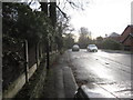
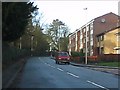
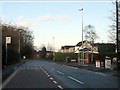
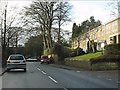
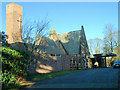
9 photos from this area
Area Information
Key information about the SK10 3AN including its size, population, and administrative classification.
- Area Type
- Postcode
- Area Size
- 1.3 hectares
- Population
- 1353
- Population Density
- 3583 people/km²
House Prices in SK10 3AN
21
Properties
£201,880
Average Sold Price
£38,700
Lowest Price
£880,000
Highest Price
Showing 21 properties
| Address | Type | Beds | Baths | Last Sale Price | Last Sale Date | |
|---|---|---|---|---|---|---|
| 8 Merriden Road, Macclesfield, SK10 3AN | Flat | - | - | £100,000 | Apr 2023 | |
| 10 Merriden Road, Macclesfield, SK10 3AN | Flat | - | - | £105,000 | Jan 2023 | |
| 34 Merriden Road, Macclesfield, SK10 3AN | house | - | - | £266,000 | Sep 2021 | |
| 5 Merriden Road, Macclesfield, SK10 3AN | Semi-detached | 3 | - | £250,000 | Dec 2020 | |
| 30 Merriden Road, Macclesfield, SK10 3AN | Semi-detached | 4 | 2 | £269,000 | Jul 2018 | |
| 1 Merriden Road, Macclesfield, SK10 3AN | Semi-detached | 3 | 1 | £187,000 | Oct 2017 | |
| 15 Merriden Road, Macclesfield, SK10 3AN | Semi-detached | 3 | 1 | £155,000 | Apr 2016 | |
| 17 Merriden Road, Macclesfield, SK10 3AN | house | - | - | £151,000 | Nov 2013 | |
| 7 Merriden Road, Macclesfield, SK10 3AN | Semi-detached | 3 | 1 | £141,500 | Apr 2012 | |
| 11 Merriden Road, Macclesfield, SK10 3AN | Semi-detached | 3 | 1 | £163,000 | Aug 2010 |
Page 1 of 3
Energy Efficiency in SK10 3AN
Amenities
Schools
| Rank | School | Type | Entry gender | Ages |
|---|
Explore more schools in this area
Go to Schools tabDemographics
Household Size
One person
most common
Accommodation Type
Houses
most common
Tenure
75
majority
Ethnic Group
White
most common
Religion
N/A
most common
Household Composition
N/A
most common
Age
47
median
Adults (30-64 years)
most common
Household Deprivation
N/A
with no deprivation
NS-SEC
30
in Lower managerial occupations
Explore more demographic insights in this area
Go to Demographics tabPlanning
Planning Constraints
- Flood RiskPremium
- Ramsar Wetland SitesPremium
- Area of Outstanding Natural BeautyPremium
- Protected Nature ReservePremium
- Protected WoodlandPremium