Area Overview for SK10 2RY
Photos of SK10 2RY
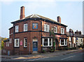
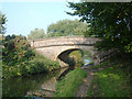
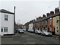
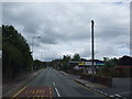
60 photos from this area
Area Information
Key information about the SK10 2RY including its size, population, and administrative classification.
- Area Type
- Postcode
- Area Size
- 1.2 hectares
- Population
- 1891
- Population Density
- 2922 people/km²
House Prices in SK10 2RY
21
Properties
£171,489
Average Sold Price
£64,850
Lowest Price
£272,600
Highest Price
Showing 21 properties
| Address | Type | Beds | Baths | Last Sale Price | Last Sale Date | |
|---|---|---|---|---|---|---|
| 11 Brocklehurst Avenue, Macclesfield, SK10 2RY | house | - | - | £250,000 | Apr 2024 | |
| 22 Brocklehurst Avenue, Macclesfield, SK10 2RY | Semi-detached | 3 | 1 | £272,600 | Oct 2023 | |
| 9 Brocklehurst Avenue, Macclesfield, SK10 2RY | Terraced | 3 | 1 | £190,000 | Jan 2020 | |
| 5 Brocklehurst Avenue, Macclesfield, SK10 2RY | Terraced | 3 | - | £152,500 | Mar 2015 | |
| 24 Brocklehurst Avenue, Macclesfield, SK10 2RY | house | - | - | £158,500 | Sep 2014 | |
| 26 Brocklehurst Avenue, Macclesfield, SK10 2RY | house | - | - | £125,000 | Aug 2011 | |
| 7 Brocklehurst Avenue, Macclesfield, SK10 2RY | Terraced | - | - | £110,000 | Jul 2006 | |
| 2 Brocklehurst Avenue, Macclesfield, SK10 2RY | Detached | - | - | £219,950 | Jun 2006 | |
| 13 Brocklehurst Avenue, Macclesfield, SK10 2RY | Semi-detached | - | - | £64,850 | Jul 2004 | |
| 12 Brocklehurst Avenue, Macclesfield, SK10 2RY | Semi-detached | - | - | - | - |
Page 1 of 3
Energy Efficiency in SK10 2RY
Amenities
Schools
| Rank | School | Type | Entry gender | Ages |
|---|
Explore more schools in this area
Go to Schools tabDemographics
Household Size
One person
most common
Accommodation Type
Houses
most common
Tenure
53
majority
Ethnic Group
White
most common
Religion
N/A
most common
Household Composition
N/A
most common
Age
47
median
Adults (30-64 years)
most common
Household Deprivation
N/A
with no deprivation
NS-SEC
30
in Lower managerial occupations
Explore more demographic insights in this area
Go to Demographics tabPlanning
Planning Constraints
- Flood RiskPremium
- Ramsar Wetland SitesPremium
- Area of Outstanding Natural BeautyPremium
- Protected Nature ReservePremium
- Protected WoodlandPremium