Area Overview for SK10 2BJ
Photos of SK10 2BJ
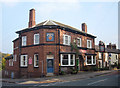
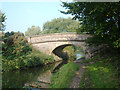
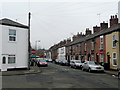
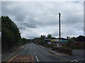
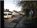
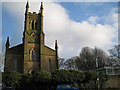
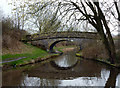
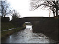
60 photos from this area
Area Information
Key information about the SK10 2BJ including its size, population, and administrative classification.
- Area Type
- Postcode
- Area Size
- 6797 m²
- Population
- 1891
- Population Density
- 2922 people/km²
House Prices in SK10 2BJ
24
Properties
£170,582
Average Sold Price
£54,950
Lowest Price
£350,000
Highest Price
Showing 24 properties
| Address | Type | Beds | Baths | Last Sale Price | Last Sale Date | |
|---|---|---|---|---|---|---|
| 7 Lowerfield Road, Macclesfield, SK10 2BJ | house | - | - | £235,000 | Sep 2025 | |
| 16 Lowerfield Road, Macclesfield, SK10 2BJ | Semi-detached | 4 | 2 | £350,000 | Feb 2025 | |
| 24 Lowerfield Road, Macclesfield, SK10 2BJ | house | - | - | £296,000 | Dec 2021 | |
| 15 Lowerfield Road, Macclesfield, SK10 2BJ | house | - | - | £202,500 | Nov 2021 | |
| 23 Lowerfield Road, Macclesfield, SK10 2BJ | Detached | 3 | - | £215,000 | Feb 2019 | |
| 11 Lowerfield Road, Macclesfield, SK10 2BJ | Terraced | - | - | £125,000 | Jan 2018 | |
| 18 Lowerfield Road, Macclesfield, SK10 2BJ | Semi-detached | 3 | - | £160,000 | Jul 2015 | |
| 19 Lowerfield Road, Macclesfield, SK10 2BJ | Terraced | 3 | - | £134,250 | Sep 2014 | |
| 2 Lowerfield Road, Macclesfield, SK10 2BJ | Terraced | 3 | - | £146,950 | Jul 2014 | |
| 17 Lowerfield Road, Macclesfield, SK10 2BJ | house | - | - | £135,500 | Nov 2010 |
Page 1 of 3
Energy Efficiency in SK10 2BJ
Amenities
Schools
| Rank | School | Type | Entry gender | Ages |
|---|
Explore more schools in this area
Go to Schools tabDemographics
Household Size
One person
most common
Accommodation Type
Houses
most common
Tenure
53
majority
Ethnic Group
White
most common
Religion
N/A
most common
Household Composition
N/A
most common
Age
47
median
Adults (30-64 years)
most common
Household Deprivation
N/A
with no deprivation
NS-SEC
30
in Lower managerial occupations
Explore more demographic insights in this area
Go to Demographics tabPlanning
Planning Constraints
- Flood RiskPremium
- Ramsar Wetland SitesPremium
- Area of Outstanding Natural BeautyPremium
- Protected Nature ReservePremium
- Protected WoodlandPremium