Area Overview for SK10 1FB
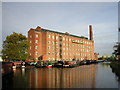
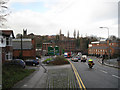
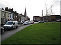
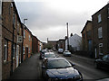
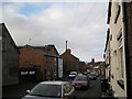
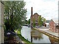
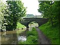
Photos of SK10 1FB


Area Information
Living in SK10 1FB offers a quiet residential experience within a defined cluster of homes. This postcode serves approximately 1,891 residents, forming a compact community focused on domestic life rather than commercial activity. The area is situated in England, providing a stable setting for families and individuals seeking a settled environment. Your daily routine will centre around your own property and the immediate neighbourhood, as this location functions as a specific residential zone rather than a town centre. You will find that life here is measured and predictable. The population size means you will know the area well, without the chaos of large urban centres. This location stands as a clear option for those who prioritise a calm routine over bustling city life. You should expect a straightforward existence where your home is the primary focus of your day. The area provides a solid foundation for settling down without the distractions of bustling streets or heavy footfall. Your proximity to local services will remain consistent, supporting a steady lifestyle. This postcode is about consistency and a peaceful domestic sphere.
- Area Type
- Postcode
- Area Size
- Not available
- Population
- 1891
- Population Density
- 2922 people/km²
The housing market in SK10 1FB is defined by a majority of owner-occupied homes. With 53 per cent of residents owning their properties, you are entering an established market where成家 home owners dominate the landscape. Houses remain the primary accommodation type, meaning you will search mainly for traditional family structures rather than flats or apartments. This skew implies that the building stock consists of substantial properties designed for families rather than high-density urban living. Buyers looking at this postcode should expect a mix of well-established homes rather than new developments or conversion projects. The high ownership rate indicates that the area attracts purchasers who intend to stay long-term. You will find fewer landlords and more families committed to their addresses. This dynamic creates a stable environment where property values are influenced by local demand from home buyers rather than rental yields. Your options will centre on houses that have served families for many years. The market characteristics suggest a slower, more considered buying process focused on finding the right house for the long term.
House Prices in SK10 1FB
No properties found in this postcode.
Energy Efficiency in SK10 1FB
Your daily lifestyle in SK10 1FB revolves around reasonable access to key amenities without needing to travel far. You have four railway stations within practical reach, including Macclesfield Railway Station, Prestbury Railway Station, and Adlington Railway Station. These connections allow you to commute efficiently to nearby employment hubs across Cheshire. For your weekly shopping, you can visit Aldi Macclesfield, Co-op Hurdsfield, and Tesco Macclesfield, all listed as nearby retail options within comfortable driving distance. These supermarkets cover your essential grocery needs without requiring a long journey. Manchester Woodford Airport sits as a nearby amenity, offering convenient access to national travel if required. The area provides a functional balance where daily necessities are accessible yet the environment remains residential. You will find that your routine allows time for errands without the stress of heavy traffic. The named retail and transport venues give you concrete options for planning your schedule. This blend of transport and retail facilities supports a practical, efficient everyday life in the neighbourhood.
Amenities
Schools
| Rank | School | Type | Entry gender | Ages |
|---|
Explore more schools in this area
Go to Schools tabDemographics
The community in SK10 1FB reflects a mature population with a median age of 47 years. Adults between 30 and 64 years represent the most common age range, indicating this neighbourhood attracts established individuals and families. You will encounter a population that has likely spent significant time building their lives in the region. Home ownership stands at 53 per cent, showing that nearly half the residents own their properties outright or with a mortgage. This figure suggests a stable tenant-free or owner-led environment rather than a transient rental market. Houses form the predominant accommodation type, meaning you will look primarily at detached, semi-detached, or terraced family homes. The predominant ethnic group is White, aligning with the broader demographics of many residential clusters in the region. These figures paint a picture of a settled, middle-aged adult community focused on stability. You should anticipate neighbours who value long-term residency over short-term moves. The age profile and ownership data confirm this is a place for people grounded in the area.
Household Size
Accommodation Type
Tenure
Ethnic Group
Religion
Household Composition
Age
Household Deprivation
NS-SEC
Explore more demographic insights in this area
Go to Demographics tabPlanning
Planning Constraints
- Flood RiskPremium
- Ramsar Wetland SitesPremium
- Area of Outstanding Natural BeautyPremium
- Protected Nature ReservePremium
- Protected WoodlandPremium