Area Overview for SK1 4EL
Photos of SK1 4EL
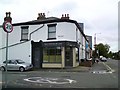
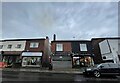
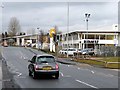
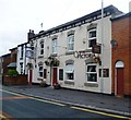
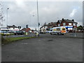
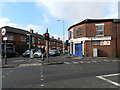
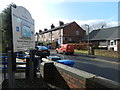
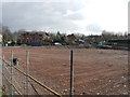
26 photos from this area
Area Information
Key information about the SK1 4EL including its size, population, and administrative classification.
- Area Type
- Postcode
- Area Size
- 9811 m²
- Population
- 1646
- Population Density
- 6126 people/km²
House Prices in SK1 4EL
18
Properties
£155,923
Average Sold Price
£46,000
Lowest Price
£275,000
Highest Price
Showing 18 properties
| Address | Type | Beds | Baths | Last Sale Price | Last Sale Date | |
|---|---|---|---|---|---|---|
| 43 Webb Lane, Offerton, Stockport, SK1 4EL | Semi-detached | 3 | 1 | £275,000 | Sep 2023 | |
| 45 Webb Lane, Offerton, Stockport, SK1 4EL | Bungalow | 2 | - | £240,000 | Aug 2022 | |
| 49 Webb Lane, Offerton, Stockport, SK1 4EL | house | - | - | £250,000 | Jul 2022 | |
| 37 Webb Lane, Offerton, Stockport, SK1 4EL | house | - | - | £180,000 | Sep 2021 | |
| 27 Webb Lane, Offerton, Stockport, SK1 4EL | Terraced | 2 | 1 | £120,000 | May 2021 | |
| 21 Webb Lane, Offerton, Stockport, SK1 4EL | Terraced | 2 | 1 | £136,000 | Mar 2021 | |
| 19 Webb Lane, Offerton, Stockport, SK1 4EL | house | - | - | £158,000 | May 2020 | |
| 35 Webb Lane, Offerton, Stockport, SK1 4EL | Terraced | 2 | 1 | £155,000 | Mar 2019 | |
| 47 Webb Lane, Offerton, Stockport, SK1 4EL | Bungalow | 2 | - | £121,000 | Sep 2014 | |
| 17 Webb Lane, Offerton, Stockport, SK1 4EL | Semi-detached | 3 | 1 | £130,000 | Apr 2008 |
Page 1 of 2
Energy Efficiency in SK1 4EL
Amenities
Schools
| Rank | School | Type | Entry gender | Ages |
|---|
Explore more schools in this area
Go to Schools tabDemographics
Household Size
One person
most common
Accommodation Type
Houses
most common
Tenure
65
majority
Ethnic Group
White
most common
Religion
N/A
most common
Household Composition
N/A
most common
Age
47
median
Adults (30-64 years)
most common
Household Deprivation
N/A
with no deprivation
NS-SEC
29
in Lower managerial occupations
Explore more demographic insights in this area
Go to Demographics tabPlanning
Planning Constraints
- Flood RiskPremium
- Ramsar Wetland SitesPremium
- Area of Outstanding Natural BeautyPremium
- Protected Nature ReservePremium
- Protected WoodlandPremium