Area Overview for Shap Rural
Photos of Shap Rural
Area Information
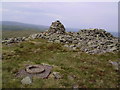
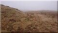
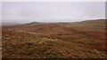
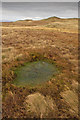
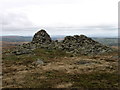
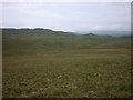
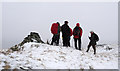
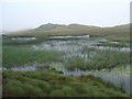
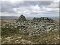
Living in Shap Rural offers a distinct experience defined by its size and rural isolation. This civil parish spreads across 103.7 square kilometres, placing you deep within the heart of the Lake District. The landscape is expansive and undeniably remote, as the area contains protected nature reserves and protected woodland that shape the environment. You are not in a typical village setting; you are in a large parish where the scale of the land dominates daily life. While the crime risk remains low with a safety score of 81 out of 100, the rural location means services are not immediately on your doorstep. The median age of residents is 70, which indicates a community that skews significantly older than the national average. This demographic reality defines the character of the parish, creating a quiet atmosphere where development pressure is minimal but social infrastructure may reflect an elderly population. Homes in Shap Rural are primarily owned by current occupants rather than being part of a student or professional rental market. Your daily commute to larger towns like Penrith or Windermere will require careful planning, as public transport links are sparse in such a vast geographical area. The area also passes assessments for flood risk and Ramsar wetland sites, confirming that the primary environmental constraints come from conservation zones rather than industrial or flood threats.
- Area Type
- Parish
- Area Size
- 103.7 km²
- Population
- Not available
- Population Density
- Not available
Demographics
The community in Shap Rural is defined by an exceptionally old population and high levels of home ownership. Data shows a median age of 70 years, meaning more than half of the residents are over this age threshold. This profile suggests a retirement destination or a location chosen for retirement rather than for young families seeking schools near the area or access to local universities. Home ownership stands at 75 percent, which is significantly higher than the national average. This statistic confirms that most people living in Shap Rural have purchased their property or inherited it from previous generations. There is very little likelihood of finding a large private rental sector in this parish because the housing stock is dominated by owner-occupiers. The household composition data indicates that families with children may be in the minority here due to the age structure. You will find that neighbours are likely to be permanent residents who have lived in Shap Rural for decades. This stability creates a close-knit sense of community, but it can also mean that local traditions are deeply entrenched. The lack of young professionals affects the local economy and the frequency of social activities tailored to younger demographics. When considering living in Shap Rural, you must acknowledge that the area is not designed for a multi-generational approach to housing.
Household Size
Accommodation Type
Tenure
Ethnic Group
Religion
Household Composition
Age
Household Deprivation
NS-SEC
Explore more demographic insights in this area
Go to Demographics tabPlanning
Planning Constraints
- Flood RiskPremium
- Ramsar Wetland SitesPremium
- Area of Outstanding Natural BeautyPremium
- Protected Nature ReservePremium
- Protected WoodlandPremium