Area Overview for Sefton Park Ward
Photos of Sefton Park Ward

Area Information
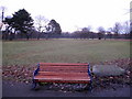
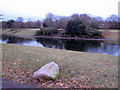
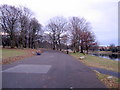
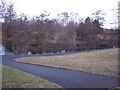
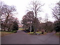
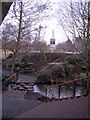
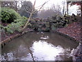
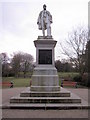
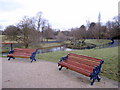
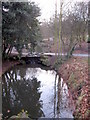
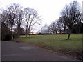
Sefton Park Ward stands as a distinct postal and electoral area within Liverpool City Council, covering 1.6 square kilometres in the south of the city. This ward encompasses the historic grounds of Sefton Park, a designated Grade I public garden that sits at the heart of the community. The population totals 1,465 residents, creating a tightly knit neighbourhood defined by its proximity to this significant green space. Life here is closely tied to the local environment, with the ward sitting near key districts such as Toxteth, Aigburth, Mossley Hill, Wavertree, and St Michael's Hamlet. The area holds postcodes primarily within the L17 range, serving a small but defined community. Residents enjoy immediate access to one of Liverpool's most celebrated parks, which spans 235 acres. This combination of historic landscape and compact residential footprint gives the ward a specific character that differs from surrounding urban zones. You live in an area where space is managed carefully around a major public asset, offering a blend of quiet living and cultural heritage without the sprawling infrastructure often found outside the city centre.
- Area Type
- District Borough Unitary Ward
- Area Size
- 1.6 km²
- Population
- 1465
- Population Density
- 922 people/km²
Demographics
The community within Sefton Park Ward shows an older demographic profile compared to the national average. The median age for residents is 70 years, indicating a population skewed toward retirement and later life stages. While specific age breakdowns beyond this median are not detailed in the available records, the overall picture suggests a mature neighbourhood often associated with historic estates. Home ownership stands at 37 percent, meaning two-thirds of households are not owner-occupied. This suggests a significant presence of long-term tenants or shared ownership schemes alongside private landlords. Accommodation types, ethnic composition, and religious affiliations are recorded in the ward's total census data, reflecting the diversity of the people calling this small ward home. With a population density of 922 people per square kilometre, the area balances urban proximity with localized community interaction. This density supports essential local services while maintaining a manageable scale for daily living. You are buying into a ward where the residents are largely settled, and community structures have likely evolved to serve an elderly or semi-retired population group.
Household Size
Accommodation Type
Tenure
Ethnic Group
Religion
Household Composition
Age
Household Deprivation
NS-SEC
Explore more demographic insights in this area
Go to Demographics tabPlanning
Planning Constraints
- Flood RiskPremium
- Ramsar Wetland SitesPremium
- Area of Outstanding Natural BeautyPremium
- Protected Nature ReservePremium
- Protected WoodlandPremium