Area Overview for Sedgley Ward
Photos of Sedgley Ward


Area Information
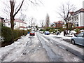
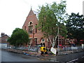
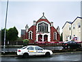
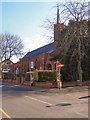
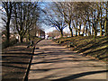
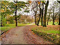
Sedgley Ward is a compact district covering 2.0 km² within the Dudley borough in the West Midlands. You will find this area situated on the A459 road between Wolverhampton and Dudley, blending suburban calm with historic charm. The ward tracks back to its origins as the seat of an ancient manor, which became part of the Dudley County Borough in 1966. Its boundaries once included the villages of Gornal, Gospel End, and Coseley, though the civil parish was abolished that year. Today, the area feels like a cosy community hub sandwiched between two larger towns, offering local shops, cafés, and pubs. Residents enjoy access to key local features including Sedgley Beacon, a hill marking a boundary at 235m height, and Alder Coppice, a Nature Reserve designated in November 2019. For those seeking recreation, Sedgley Hall Park provides children's playing facilities within the grounds of a former 15th-century house. You can find practical amenities nearby, such as Sedgley Library and the Medical Centre. While there are no direct canals, bus routes like the 224 and 229 link you to Dudley and Tipton. This ward offers a specific slice of life defined by its location on the edge of the Black Country, providing a distinct alternative to the larger urban centres nearby.
- Area Type
- District Borough Unitary Ward
- Area Size
- 2.0 km²
- Population
- Not available
- Population Density
- Not available
Demographics
You should understand the community profile before looking at homes in Sedgley Ward. The demographic landscape is heavily weighted towards older residents, with a median age of 70 years. The data indicates this is an area housing a significant proportion of seniors, suggesting a neighbourhood accustomed to quiet living rather than youthful energy. Home ownership stands at 69%, which exceeds the national average and signals that most people in Sedgley Ward have purchased their properties outright or have long-term security over their homes. This high ownership rate typically correlates with a stable, established population. The ward does not function as a primary rental market; instead, it serves as a settled location where families and individuals tend to stay for the long term. You will not find diverse age ranges typical of mixed estates here, as the population reflects a specific stage of life. The historical context of the 1961 census population of 27,912 for the broader parish helps frame the current density within these 2.0 km² boundaries. Living in Sedgley Ward means joining a community where the primary resident demographic prioritises stability and established neighbourhood hierarchies familiar to older generations.
Household Size
Accommodation Type
Tenure
Ethnic Group
Religion
Household Composition
Age
Household Deprivation
NS-SEC
Explore more demographic insights in this area
Go to Demographics tabPlanning
Planning Constraints
- Flood RiskPremium
- Ramsar Wetland SitesPremium
- Area of Outstanding Natural BeautyPremium
- Protected Nature ReservePremium
- Protected WoodlandPremium
- Crime RiskPremium