Area Overview for Seascale
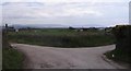
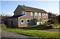
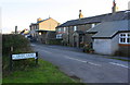
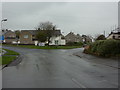
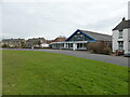
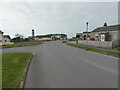
Photos of Seascale
Area Information
Living in Seascale offers a distinct blend of quiet residential life and practical connectivity. Covering 78.9 hectares, this built-up area in England is characterised by its mature population, with a median age of 70, suggesting a community rooted in long-term residency. The high home ownership rate of 86% indicates a stable, settled demographic. Daily life here is shaped by proximity to essential services, including five retail outlets such as Co-op Seascale and Spar, and multiple rail links like Seascale and Sellafield stations. While the area’s size is modest, it provides access to nearby amenities, including primary education and public transport. Seascale’s appeal lies in its balance of simplicity and accessibility, though its digital connectivity remains a consideration for those reliant on high-speed broadband. For buyers seeking a low-crime, owner-occupied environment with practical infrastructure, Seascale presents a straightforward option.
- Area Type
- Built Up Area 250
- Area Size
- 78.9 hectares
- Population
- Not available
- Population Density
- Not available
Seascale’s lifestyle is shaped by its proximity to essential amenities. Five retail outlets, including Co-op Seascale and Budgens Gosforth, offer everyday shopping needs, while nearby metro stops at Muncaster Mill and Miteside provide access to broader leisure and transport networks. The rail stations, such as Sellafield and Drigg, connect residents to regional hubs, enhancing mobility. Though the area lacks expansive parks or recreational facilities, its compact design ensures services are within practical reach. The mix of retail, transport, and community-focused amenities supports a functional daily life, though the absence of cultural or entertainment venues may require residents to travel for more varied experiences.
Amenities
Schools
Seascale Primary School is the only named educational institution in the area, offering primary education with a “Good” Ofsted rating. This single school serves the local community, though the absence of secondary schools or specialist provisions may require families to travel to nearby towns for higher education. The school’s rating indicates a satisfactory standard of teaching and facilities, but the lack of additional educational options could be a limitation for growing families. For those prioritising proximity to schools, Seascale provides a basic foundation, though broader educational needs may necessitate planning for commuting.
| Rank | School | Type | Entry gender | Ages |
|---|
Explore more schools in this area
Go to Schools tabDemographics
Seascale’s population skews significantly towards older age groups, with a median age of 70. This suggests a community where retirement is the dominant life stage, though the most common age range is listed as “Total,” indicating broad representation. Home ownership is exceptionally high at 86%, reflecting a predominantly owner-occupied area with limited rental activity. Accommodation types and household compositions are not specified, but the data implies a mix of family and single-person households. The area’s ethnic and religious diversity is not quantified, though the “total” category for both suggests a lack of detailed breakdowns. The absence of specific deprivation metrics means the quality of life remains unassessed in this context. For buyers, the demographic profile signals a mature, stable population with established roots, though it may not cater to younger families seeking dynamic growth.
Household Size
Accommodation Type
Tenure
Ethnic Group
Religion
Household Composition
Age
Household Deprivation
NS-SEC
Explore more demographic insights in this area
Go to Demographics tabPlanning
Planning Constraints
- Crime RiskPremium