Area Overview for Seacombe Ward
Photos of Seacombe Ward


Area Information
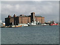
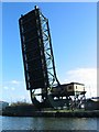
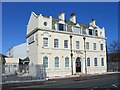
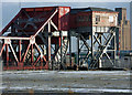
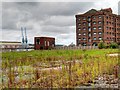
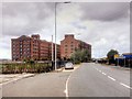
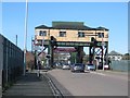
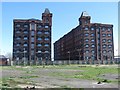
Seacombe Ward sits within the town of Wallasey on the Wirral Peninsula in north-west England. This district covers a small area of just 4.6 km², resulting in a population density of 1539 people per square kilometre. The resident population stands at approximately 7151 people. Administratively, it functions as a ward of the Metropolitan Borough of Wirral in Merseyside. Historically, the location worked as part of the County Borough of Wallasey within the geographical county of Cheshire before local government reorganisation took effect on 1 April 1974. The name derives from the meaning "Valley by the sea", reflecting its position adjacent to the River Mersey. Visitors will find the area anchored by Wallasey Town Hall, a Grade II listed building located within the ward. This structure served as a military hospital during World War I and King George V laid its foundation stone on 25 March 1914. Living in Seacombe Ward means being close to Guinea Gap Baths, which holds the distinction of being the oldest swimming pool in the Wirral. The area also contains heritage related to its history as a terminus for the Wirral Railway and the long-standing operation of Seacombe Ferry.
- Area Type
- District Borough Unitary Ward
- Area Size
- 4.6 km²
- Population
- 7151
- Population Density
- 1539 people/km²
Demographics
The community profile in Seacombe Ward suggests an older demographic structure. The median age for residents reaches 70 years, which is notably higher than the national average. Your neighbours are likely to be retirees or older adults rather than young families. With a median age at this level, the ward does not hold the large shocks of population change that younger districts experience. Future planning or community events may cater heavily to the needs of seniors. Home ownership rates in Seacombe Ward stand at 42 per cent of households. This figure indicates that roughly six out of ten residents rent their homes or live in other non-ownership arrangements. Such a lower ownership rate often characterises areas with significant leasehold stock or social housing. The ward lacks specific breakdowns for individual age ranges beyond the total, yet the dominance of the elderly profile is clear. Divergent ethnic groups or religious breakdowns are not detailed in the available statistics, meaning the community appears defined by age rather than broad cultural demographics. There is no data provided on the predominant ethnic group or religious affiliation within this specific ward.
Household Size
Accommodation Type
Tenure
Ethnic Group
Religion
Household Composition
Age
Household Deprivation
NS-SEC
Explore more demographic insights in this area
Go to Demographics tabPlanning
Planning Constraints
- Flood RiskPremium
- Ramsar Wetland SitesPremium
- Area of Outstanding Natural BeautyPremium
- Protected Nature ReservePremium
- Protected WoodlandPremium
- Crime RiskPremium