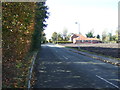
Area Overview for Scarisbrick
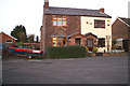
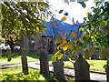
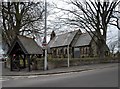
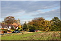
Photos of Scarisbrick


Area Information
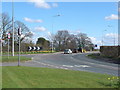
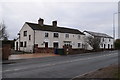
Scarisbrick is a compact built-up area in England, covering 36.8 hectares. Its population, while not explicitly stated, is reflected in its high median age of 70, suggesting a community skewed toward older residents. The area’s proximity to amenities like railway stations and retail hubs such as Tesco Southport and Spar indicates practical accessibility for daily needs. Scarisbrick St Mark’s Church of England Primary School, rated good by Ofsted, serves local families, adding to the area’s appeal for households with young children. The 82% home ownership rate highlights a stable, owner-occupied community, with accommodation types and household compositions largely unbroken in the data. While the area lacks explicit details on diversity or cultural landmarks, its rail network—featuring stations like Bescar Lane and Meols Cop—connects residents to broader regional routes. For those seeking a quieter, well-connected neighbourhood with a focus on practical living, Scarisbrick offers a blend of convenience and low crime risk, making it a viable option for buyers prioritising safety and accessibility.
- Area Type
- Built Up Area 250
- Area Size
- 36.8 hectares
- Population
- Not available
- Population Density
- Not available
Daily life in Scarisbrick is shaped by its proximity to practical amenities. The area’s retail options include major stores like Tesco Southport and Aldi Meols, ensuring access to groceries and everyday goods. Five railway stations—such as Bescar Lane and New Lane—provide easy connections to nearby towns and cities, enhancing mobility for commuters. The presence of RAF Woodvale airport, while not a local hub, adds to the area’s accessibility. For leisure, the data does not specify parks or recreational facilities, but the rail network and retail options suggest a focus on convenience over extensive leisure amenities. The community’s character is defined by its older demographic and stable housing stock, with the well-rated primary school serving as a focal point for families. While the area lacks detailed information on cultural or recreational spots, its practical amenities make it suitable for those prioritising accessibility and connectivity.
Amenities
Schools
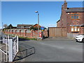
The nearest school to Scarisbrick is Scarisbrick St Mark’s Church of England Primary School, a primary institution with a good Ofsted rating. This school serves the local community, offering education for younger children and contributing to the area’s family-friendly appeal. The absence of secondary schools in the dataset means the data does not cover higher education options, but the presence of a well-rated primary school is a key consideration for families. The school’s good rating suggests it meets or exceeds national standards in teaching and facilities, which is a positive factor for parents prioritising quality education. For those seeking a school within walking distance, Scarisbrick’s primary school provides a reliable option, though further research would be needed to assess secondary schooling options in the surrounding region.
| Rank | School | Type | Entry gender | Ages |
|---|
Explore more schools in this area
Go to Schools tabDemographics
Scarisbrick’s population has a median age of 70, the highest in the dataset, suggesting a community predominantly composed of older individuals. The most common age range is listed as “Age: Total,” which may reflect aggregated statistics rather than specific age brackets. Home ownership here is robust, with 82% of households owning their homes—a figure that implies long-term residency and stability. The data does not specify household types, accommodation categories, or ethnic diversity, but the high home ownership rate and lack of detailed demographic breakdowns suggest a relatively homogeneous population. While the area’s older demographic may influence local services and amenities, it also contributes to a low-crime environment, as noted in the safety assessment. The absence of explicit data on deprivation or income levels means these factors remain unexplored in the context of quality of life.
Household Size
Accommodation Type
Tenure
Ethnic Group
Religion
Household Composition
Age
Household Deprivation
NS-SEC
Explore more demographic insights in this area
Go to Demographics tabPlanning
Planning Constraints
- Crime RiskPremium