Area Overview for Satterthwaite
Photos of Satterthwaite
Area Information
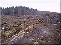
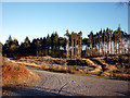
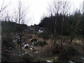
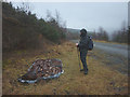
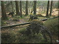
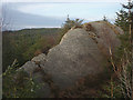
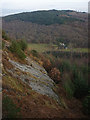
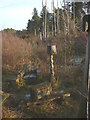
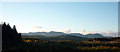
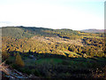
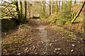
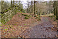
Satterthwaite operates as a civil parish covering an extensive 29.6 square kilometres. The location functions largely as a residential settlement within the broader landscape, offering space for those seeking quieter surroundings away from urban congestion. You will find that daily life here focuses on a rural rather than metropolitan experience, with the land itself defining the character of the neighbourhood. The area does not feature protected status such as an Area of Outstanding Natural Beauty or Ramsar wetland sites, which simplifies planning constraints for future developments. Instead, the landscape includes managed protected woodland that contributes to the local green infrastructure without imposing the strict limitations found in designated nature reserves. Residents enjoy a relatively low flood risk, achieving a safety score that places the parish well above average in terms of environmental security against water overflow. This combination of open space and manageable environmental risks makes Satterthwaite a practical choice for buyers who prioritise land access and long-term stability. The community maintains a distinct identity defined by its size and lack of restrictive planning overlays.
- Area Type
- Parish
- Area Size
- 29.6 km²
- Population
- Not available
- Population Density
- Not available
Demographics
The population profile of Satterthwaite reflects a mature residents base with a median age of 70 years. This high demographic indicates that the parish attracts older individuals who value stability and established communities over rapid urban growth. You will encounter a household composition typical of retirement areas or long-stay neighbourhoods where families may have relocated after child-rearing years. Homeownership stands at 60 per cent of the total, suggesting that three out of every five residents own their property outright or have a mortgage. This ownership rate supports a stable local economy where homeowners invest in maintenance rather than seeking quick rental turnovers. Accommodation types follow this demographic trend, likely favouring detached or semi-detached homes suitable for single occupants or couples rather than dense urban flats. The ethnic and religious data is not detailed in available records, but the high age profile suggests a culturally diverse cohort of retirees who have settled permanently. Deprivation metrics are not included, yet the high ownership rate implies a degree of financial security among the long-term population. You can expect a quiet, settled environment where the average resident prioritises comfort and low maintenance living.
Household Size
Accommodation Type
Tenure
Ethnic Group
Religion
Household Composition
Age
Household Deprivation
NS-SEC
Explore more demographic insights in this area
Go to Demographics tabPlanning
Planning Constraints
- Flood RiskPremium
- Ramsar Wetland SitesPremium
- Area of Outstanding Natural BeautyPremium
- Protected Nature ReservePremium
- Protected WoodlandPremium
- Crime RiskPremium