Area Overview for Saddleworth West & Lees Ward
Photos of Saddleworth West & Lees Ward
Area Information
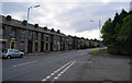
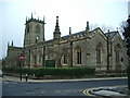
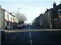
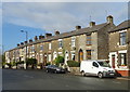
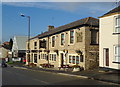
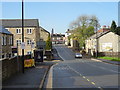
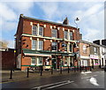
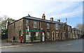
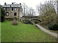
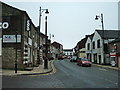
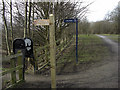
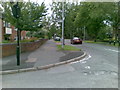
Living in Saddleworth West & Lees Ward places you within a distinct rural landscape on the western side of the Pennine hills. This electoral ward forms part of the civil parish of Saddleworth, which sits roughly 11 miles northeast of Manchester yet remains firmly grounded in its local character. The area spans a relatively compact 4.2 km², accommodating a population of 1,451 residents. Despite its location within the Metropolitan Borough of Oldham in Greater Manchester, Saddleworth retains strong historical ties to Yorkshire, a heritage that shapes the daily rhythm of life here. The ward sits at coordinates 53.535°N, 2.063°W, near settlements like Greenfield and Grotton, and borders the Dark Peak area of the Peak District National Park. You will find a community defined by rolling moorland and a collection of villages and hamlets rather than dense urban sprawl. The ward is bounded by Oldham and the Metropolitan Borough of Rochdale to the north, Tameside to the south, and Kirklees to the east. With Huddersfield located approximately 12 miles southwest, the area offers a quiet retreat from city life while remaining connected to key regional hubs. Saddleworth West & Lees Ward presents an environment where history meets modern infrastructure, offering a specific slice of the Saddleworth experience for those seeking space and tranquility.
- Area Type
- District Borough Unitary Ward
- Area Size
- 4.2 km²
- Population
- 1451
- Population Density
- 342 people/km²
Demographics
The community in Saddleworth West & Lees Ward is markedly older than many other regions in England. The median age stands at 70 years, indicating a population dominated by retirees and long-term residents. Within this demographic, the total age categories show a mature profile that influences local services and community activities. You will find a high level of stability in housing tenure, with 72% of residents owning their homes outright or with a mortgage. This contrasts significantly with areas where renting is common, suggesting deep roots in the neighbourhood. The ward's population density of 342 people per km² creates a living environment that feels spacious yet community-focused. Accommodation types reflect this ownership status, though specific breakdowns of detached versus semi-detached housing are not detailed in the current data. The area does not show specific data on predominant ethnic groups, religion, or detailed household composition splits, but the high home ownership rate suggests a settled community. For buyers, the age profile means a neighbourhood likely accustomed to quiet streets and a pace of life suited to retirement or later life stages. The demographic reality of a 70-year median age defines the social fabric of Saddleworth West & Lees Ward.
Household Size
Accommodation Type
Tenure
Ethnic Group
Religion
Household Composition
Age
Household Deprivation
NS-SEC
Explore more demographic insights in this area
Go to Demographics tabPlanning
Planning Constraints
- Flood RiskPremium
- Ramsar Wetland SitesPremium
- Area of Outstanding Natural BeautyPremium
- Protected Nature ReservePremium
- Protected WoodlandPremium
- Crime RiskPremium