Area Overview for Rusholme Ward
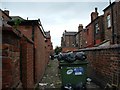
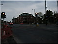
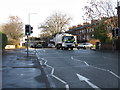
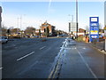
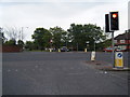
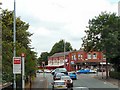
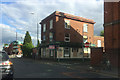
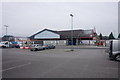
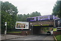
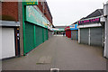
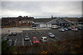
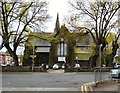
Photos of Rusholme Ward
Area Information
Living in Rusholme Ward offers a distinctly different experience compared to the wider Manchester suburbs. This inner-city ward covers an area of just 2.2 km² yet supports a population of 2,265 residents, resulting in a density of 1,052 people per square kilometre. You are looking at a compact district that has evolved from a 19th-century agricultural village into a diverse residential hub south of the city centre. The area is uniquely characterised by its multicultural background, where over 70 languages are reportedly spoken around Wilmslow Road, locally known as the Curry Mile. Historical records reveal a deep-rooted community spirit, highlighted by the opening of the Rusholme Public Hall and Library on 14 January 1860. This landmark Elizabethan building was funded by public subscription to provide moral and intellectual improvement for the original residents. While the ward now forms part of the City of Manchester, it retains a separate identity within the local economy, centred on food production and television heritage. Daily life here is defined by close proximity to notable green spaces like the Victoria Park Estate, established in 1837, and the cultural vibrancy of the Curry Mile. You will find yourself in a neighbourhood where Victorian architectural heritage meets modern multicultural commerce, creating a living environment that is densely populated yet historically significant.
- Area Type
- District Borough Unitary Ward
- Area Size
- 2.2 km²
- Population
- 2265
- Population Density
- 1052 people/km²
Demographics
The community profile of Rusholme Ward presents specific demographic realities that any prospective resident should consider. The median age stands at 70 years, a figure that significantly influences the character of the neighbourhood and the types of local services required. This high median age suggests a population skewed towards older demographics, which may shape your experience of the local environment. Home ownership rates in the area are recorded at 27 per cent, meaning that nearly three-quarters of the households reside in rented accommodation. This statistic indicates a rental-dominated market rather than a private ownership one, which will be a primary factor for anyone evaluating long-term security of tenure. The ward contains 2,265 residents spread across its 2.2 km², creating a close-knit but densely populated living situation. Your understanding of the social fabric should be grounded in these hard figures rather than assumptions. The age profile, combined with the low rate of homeownership, paints a picture of a transient or socially rented environment with a significant senior population. While the area is historically multicultural, the specific breakdown of predominant ethnic groups and detailed household composition figures are not included in the current dataset. Consequently, your view of the community must rely on the known aggregate data: a high median age and a predominantly rental stock in a compact inner-city space.
Household Size
Accommodation Type
Tenure
Ethnic Group
Religion
Household Composition
Age
Household Deprivation
NS-SEC
Explore more demographic insights in this area
Go to Demographics tabPlanning
Planning Constraints
- Flood RiskPremium
- Ramsar Wetland SitesPremium
- Area of Outstanding Natural BeautyPremium
- Protected Nature ReservePremium
- Protected WoodlandPremium
- Crime RiskPremium