Area Overview for Rural West Ward
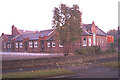
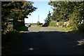
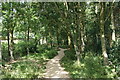
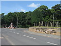
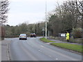
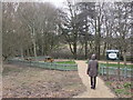
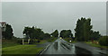
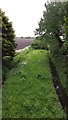
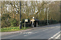
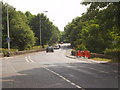
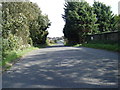
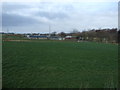
Photos of Rural West Ward
Area Information
Rural West Ward occupies a significant expanse of 90.1 square kilometres across the borough, offering a distinct living environment defined by its isolation and mature demographic. You will find that life here moves at a different pace than in urban centres, characterised by a strong sense of ownership and established community roots. The area is not a bustling metropolitan hub but rather a settled district where daily routines revolve around local amenities and natural surroundings. Prospective buyers must understand that the character of Rural West Ward is fundamentally shaped by its large residential footprint, where residents have long-term stakes in their homes. The average resident here is significantly older than the national average, creating a quiet, stable atmosphere suitable for retirees or those seeking a low-pressure lifestyle. When considering homes in Rural West Ward, you are entering a market where property values reflect decades of ownership rather than speculative buying. This area offers a genuine rural experience without the isolation of completely remote locations, provided you rely on private transport. The distinction of living in Rural West Ward lies in this specific combination of sizeable land area and an elderly population that has put down deep roots in the community. It is a place for those who prioritise peace over convenience, willing to trade proximity to city centres for a predictable, owner-occupied environment.
- Area Type
- District Borough Unitary Ward
- Area Size
- 90.1 km²
- Population
- Not available
- Population Density
- Not available
Demographics
The community in Rural West Ward presents a clear demographic profile dominated by residents aged 70 and over, with this older cohort forming the median age of the population. If you examine the age distribution, you will see a heavy skew towards retirement, meaning the social fabric is built around the needs and interests of senior citizens rather than families with young children. This concentration of elders suggests a neighbourhood where holidays are often taken together, local shops cater to older demographics, and community events reflect a mature lifestyle. Home ownership stands at 82% in Rural West Ward, which is a telling figure for understanding the area's dynamic. This high rate indicates that most homes in the district are occupied by those who have paid off their mortgages or inherited the property, leading to a stable, non-transient population. The remaining 18% of households likely comprise a small minority, possibly including long-term renters or temporary residents. Accommodation types across the ward appear to be established and traditional, fitting the older age profile of those living here. Such high ownership rates often mean fewer properties are on the market at any given time, making it competitive for new buyers. The demographics confirm that this is an area defined by permanence and a generation maturing alongside their homes.
Household Size
Accommodation Type
Tenure
Ethnic Group
Religion
Household Composition
Age
Household Deprivation
NS-SEC
Explore more demographic insights in this area
Go to Demographics tabPlanning
Planning Constraints
- Flood RiskPremium
- Ramsar Wetland SitesPremium
- Area of Outstanding Natural BeautyPremium
- Protected Nature ReservePremium
- Protected WoodlandPremium
- Crime RiskPremium