Area Overview for Rural South Ward
Photos of Rural South Ward
Area Information
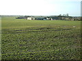
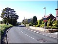
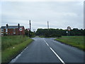
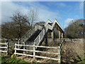
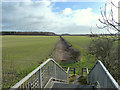
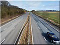
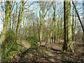
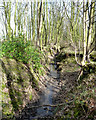
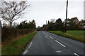
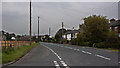
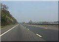
Living in Rural South Ward offers a distinctly quiet lifestyle within the West Lancashire Borough Council area. This district council ward spans 54.4 km², providing ample space for residents who prefer rural surroundings over dense urban environments. The area functions as a local community unit where daily life revolves around the natural landscape and established neighbourhoods. Prospective homebuyers should know that this ward exists within a broader administrative structure that defines local governance and services. The character of Rural South Ward is defined by its classification as a rural ward, which influences everything from local planning to the pace of life. You will find that the large physical expanse correlates with a slower rhythm compared to city centres. Families and individuals seeking a home based on limited immediate population density often gravitate toward this location. The ward covers a significant portion of land, ensuring there are distinct pockets of settlement rather than one consolidated town. Anyone researching homes in this specific ward should understand they are entering a space designed around rural living standards. The 54.4 km² footprint allows for wide streets and green spaces that dominate the visual landscape. This extensive area size means travel times between local amenities can vary depending on your exact postcode within the ward boundaries. It is a place where the definition of a local neighbourhood stretches across many kilometres of countryside.
- Area Type
- District Borough Unitary Ward
- Area Size
- 54.4 km²
- Population
- Not available
- Population Density
- Not available
Demographics
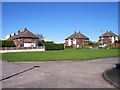
The community profile in Rural South Ward reflects a mature demographic with a median age of 70 years. This high average age indicates that the ward attracts retirees or long-term residents who have settled down. When researching schools near Rural South Ward, prospective homebuyers must recognise that the population is not typical of a young family district. The age profile suggests a retirement-friendly environment where quiet streets are a priority rather than playground traffic. Home ownership stands at 74 per cent within the ward, placing it among the highest in the region. This statistic confirms that the housing stock is primarily occupied by those who already own their properties. The high retention of existing residents explains the slower pace of turnover in the property market. You are likely to encounter neighbours who have lived in their current homes for decades, fostering a stable, albeit less transient, community feel. The census data shows that household composition and accommodation type breakdowns are recorded at the total ward level. While specific figures for individual household sizes or specific dwelling types are not broken down further in the available records, the ownership rate provides a clear picture of tenure. The dominant presence of owner-occupied homes shapes the local culture, where property value often aligns with long-term stability rather than speculative investment. This demographic reality makes the area suitable for those seeking a permanent residence rather than a rental property.
Household Size
Accommodation Type
Tenure
Ethnic Group
Religion
Household Composition
Age
Household Deprivation
NS-SEC
Explore more demographic insights in this area
Go to Demographics tabPlanning
Planning Constraints
- Flood RiskPremium
- Ramsar Wetland SitesPremium
- Area of Outstanding Natural BeautyPremium
- Protected Nature ReservePremium
- Protected WoodlandPremium
- Crime RiskPremium