Area Overview for Rudheath
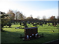
Photos of Rudheath

Area Information
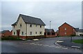
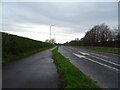
Rudheath is a compact built-up area in England, covering 1.6 km², with a population skewed towards older residents, many of whom are likely long-term residents. The area’s size makes it walkable, with local amenities and schools within practical reach. Home ownership is strong, at 70%, suggesting a stable community with a mix of long-standing and newer residents. Daily life here is shaped by proximity to schools, retail, and rail links, offering both convenience and connectivity. The presence of multiple schools and retail outlets, alongside good broadband and rail access, creates a functional environment for families and commuters. While the area’s older demographic may influence its pace of life, the infrastructure supports a practical, low-maintenance lifestyle. For those seeking a place with established services and a lower crime risk, Rudheath offers a blend of accessibility and quiet living.
- Area Type
- Built Up Area 250
- Area Size
- 1.6 km²
- Population
- Not available
- Population Density
- Not available
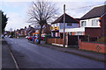
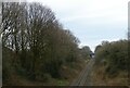
Rudheath’s lifestyle is shaped by its proximity to essential amenities. The area has five retail outlets, including Spar, Co-op Middlewich, and Tesco Northwich, offering a range of shopping options from convenience stores to larger supermarkets. These venues support daily errands and grocery needs, enhancing local convenience. Rail access is extensive, with five stations providing connections to nearby towns and cities, which is particularly useful for commuters. While parks and leisure facilities are not explicitly mentioned in the data, the presence of multiple retail and transport options suggests a functional, practical lifestyle. The combination of shops, rail links, and good broadband connectivity ensures residents can manage both daily routines and broader travel needs efficiently.
Amenities
Schools
Rudheath has a range of educational institutions, including Rudheath Community Primary School and Rudheath Community High School, both of which are primary schools. The Rudheath Senior Academy, an academy school, and Rudheath Primary Academy and Nursery, also a primary school, both hold ‘good’ Ofsted ratings. This mix of primary and academy schools provides families with options for different stages of education. The presence of multiple schools within the area suggests a strong focus on local education, with at least two institutions receiving positive evaluations. For parents, this diversity ensures access to both traditional and academically focused schooling, though the lack of secondary school data means further research would be needed for a complete picture.
| Rank | A + A* % | School | Type | Entry gender | Ages |
|---|---|---|---|---|---|
| 1 | N/A | Rudheath Community Primary School | primary | N/A | N/A |
| 2 | N/A | Rudheath Community High School | primary | N/A | N/A |
| 3 | N/A | The Rudheath Senior Academy | academy | N/A | N/A |
| 4 | N/A | Rudheath Primary Academy and Nursery | primary | N/A | N/A |
Explore more schools in this area
Go to Schools tabDemographics
Rudheath’s population has a median age of 70, indicating a community where older residents predominate. The most common age range is listed as ‘Age: Total’, which may reflect a demographic where older generations form a significant proportion. Home ownership is at 70%, suggesting a majority of residents live in their own homes rather than renting. The data does not specify household composition or accommodation types, but the high home ownership rate implies a settled, possibly retired population. There is no specific information on ethnic diversity or religious composition, so these aspects remain unquantified. The area’s demographic profile suggests a community with a focus on stability and long-term residency, though the lack of detailed breakdowns on household types or diversity means further exploration would be needed for a full picture.
Household Size
Accommodation Type
Tenure
Ethnic Group
Religion
Household Composition
Age
Household Deprivation
NS-SEC
Explore more demographic insights in this area
Go to Demographics tabPlanning
Planning Constraints
- Crime RiskLocked