Area Overview for Rope
Photos of Rope

Area Information
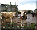
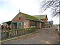
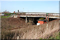
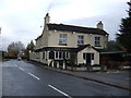
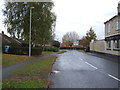
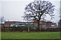
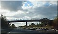
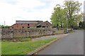
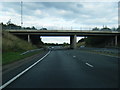
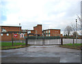
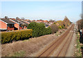
Rope is a civil parish situated in the unitary authority of Cheshire East, lying immediately south of Crewe. The town centre sits approximately 2¼ miles from Crewe town centre, placing it within easy reach of a larger urban hub while retaining a distinct rural character. Much of the 1.9 km² parish remains relatively flat, sitting at an elevation of around 50 metres. The landscape is predominantly agricultural, though urban development concentrates heavily in the north-east corner. This built-up area, known as Wells Green, sits adjacent to Wistaston and south Crewe. You will find historical connections to Wybunbury ancient parish, becoming a civil parish in 1866. The area borders nearby villages including Shavington, Willaston, and Wistaston. Connectivity relies on established road and rail networks, with the A500 trunk road running about 500 metres south of the crestline railway. The Crewe–Nantwich railway line cuts east–west through the centre of the parish. Rope Lane crosses the railway at Ropegreen Bridge, providing a direct link between Crewe and Shavington. For those seeking a location with significant green space yet close to transport links, Rope offers a compact footprint. The parish includes natural features such as Wellsgreen Brook and Swill Brook. These brooks, alongside small meres and ponds, define the character of the surrounding countryside outside the main residential zone.
- Area Type
- Parish
- Area Size
- 1.9 km²
- Population
- Not available
- Population Density
- Not available
Demographics
The community living in Rope presents a distinctly older demographic profile. You will find the median age of residents stands at 70 years. This figure indicates a settlement populated primarily by mature adults rather than young families or working-age cohorts. Historical population figures show a significant shift over the last two centuries, growing from 79 residents in 1801 to 2,155 in 2001 before settling to 2,034 in the 2011 census. Today, the household composition reflects this age dynamic, meaning services and amenities likely cater to older needs. Home ownership is the norm, with 95% of households owning their property. This high rate suggests a stable community where long-term residents have settled, rather than a transient population of renters. When considering homes in Rope, you encounter an established stock rather than new-build developments attracting first-time buyers. The predominant ethnicity data remains general to the total population without specific breakdowns. Religious diversity is similarly recorded as a total figure rather than specific breakdowns. You are buying into a quiet, stable neighbourhood where the social fabric has evolved alongside the railway and road links that service the area.
Household Size
Accommodation Type
Tenure
Ethnic Group
Religion
Household Composition
Age
Household Deprivation
NS-SEC
Explore more demographic insights in this area
Go to Demographics tabPlanning
Planning Constraints
- Flood RiskPremium
- Ramsar Wetland SitesPremium
- Area of Outstanding Natural BeautyPremium
- Protected Nature ReservePremium
- Protected WoodlandPremium
- Crime RiskPremium