Area Overview for Rock Ferry Ward
Photos of Rock Ferry Ward


Area Information
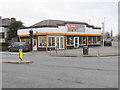
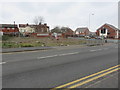
Living in Rock Ferry Ward offers a distinctive experience within the Metropolitan Borough of Wirral on the North West corner of the Wirral Peninsula. This small district covers just 5.2 km², creating a compact neighbourhood where daily needs are typically within close reach. The area sits adjacent to the River Mersey, carrying deep historical roots that extend back to 1357 when records first reference a ferry service connecting the site to Liverpool. Steam ferries expanded this maritime connection in the early 19th century, while the Royal Mersey Yacht Club, founded in 1844, established the area's recreational identity. Today, the ward contains approximately 3,664 residents, maintaining a population density of 698 people per square kilometre. You will notice the architectural legacy of the late 19th and early 20th centuries, particularly along Old Chester Road where luxurious villas built from local Storeton sandstone still stand. The conservation area known as Rock Park preserves these former merchant homes that defined the area after the Royal Rock Hotel opened in 1836. Although the famous steam ferry pier is now a historical feature rather than a daily transport hub, the legacy of the Mersey Railway extension in 1891 continues to support the local community. The ward represents a small but significant slice of Wirral's maritime history, blending its aristocratic heritage with modern residential life.
- Area Type
- District Borough Unitary Ward
- Area Size
- 5.2 km²
- Population
- 3664
- Population Density
- 698 people/km²
Demographics
The community profile of Rock Ferry Ward reflects an older demographic trend. You will find that the median age for residents is 70 years old, indicating a population skewed significantly towards the older generation. This age structure suggests a neighbourhood where many homes are likely occupied by retirees or older couples rather than young families moving directly into the area. The data shows that 39% of households are owner-occupied, which means that the majority of residents rent their properties. This high rental proportion contrasts with many other established UK districts where ownership levels are typically much higher. With a total home ownership rate below 40%, renting remains the primary method of accommodation for people living in Rock Ferry Ward. The household composition and accommodation types data confirm a reliance on the private rental sector rather than a mix of council and private ownership common in student or young professional hubs. While the area hosts a specific age range, the most common age bracket is broad across the total population. This demographic reality shapes the local economy and service demand, as the needs of an older population differ from those of younger workers. You should be aware that the neighbourhood character is influenced by this settled, older demographic profile rather than a transient or youthful workforce.
Household Size
Accommodation Type
Tenure
Ethnic Group
Religion
Household Composition
Age
Household Deprivation
NS-SEC
Explore more demographic insights in this area
Go to Demographics tabPlanning
Planning Constraints
- Flood RiskPremium
- Ramsar Wetland SitesPremium
- Area of Outstanding Natural BeautyPremium
- Protected Nature ReservePremium
- Protected WoodlandPremium
- Crime RiskPremium