Area Overview for Rochdale
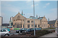
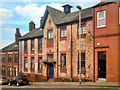
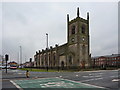
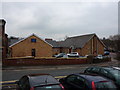
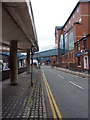
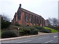
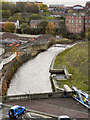
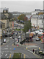
Touchstones in Rochdale
Institute For The Deaf in Rochdale
St Mary Ukrainian RC Church, Rochdale in Rochdale
St Andrew's Church, Kelsall Street, Rochdale in Rochdale
Baillie Street, Rochdale in Rochdale
St Mary's Church, Rochdale in Rochdale
River Roch, Rochdale in Rochdale
River Roch, Lviv Bridge, Smith Street in Rochdale
Rochdale, South Parade in Rochdale
Rochdale Town Hall and South Parade in Rochdale
Rochdale Municipal Offices & Multi-Storey Car Park in Rochdale
Rochdale Town Centre in Rochdale
100 photos from this area

Area Information

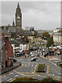
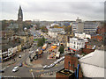
Rochdale is a built-up area in England covering 25.4 km², home to 34,100 residents. With a population density of 1,345 people per square kilometre, it is a compact, densely populated town where daily life is shaped by its proximity to urban amenities. The area’s character is defined by its mix of retail, transport hubs, and community spaces, making it practical for those prioritising convenience. While the median age of 70 suggests a community skewed towards older residents, Rochdale offers a range of services to support all age groups. Its central location, with multiple railway stations and a bustling town centre, ensures easy access to surrounding areas. For buyers, Rochdale balances affordability with accessibility, though its demographic profile may appeal more to those seeking a quieter, established environment over a rapidly growing one. The town’s infrastructure, from broadband connectivity to public transport, supports both working professionals and retirees alike.

Area Type
District/Borough
Area Size
25.4 km²
Population
34100
Population Density
1345 people/km²

Demographics

Rochdale’s population includes a median age of 70, indicating a community where older residents form a significant proportion. The home ownership rate stands at 61%, suggesting a stable housing market with a notable presence of owner-occupied properties. While the data does not specify household composition or predominant accommodation types, the high population density implies a mix of family homes, flats, and other housing forms. The area’s demographic profile, with no specific ethnic or religious breakdown provided, reflects a broad diversity typical of many urban centres. However, the lack of detailed data on deprivation or socioeconomic factors means that quality of life assessments must rely on available metrics. The presence of 5 nursery schools and a primary school with a 'good' Ofsted rating suggests efforts to support families, though further details on educational outcomes or community services are not available.

Household Size

total
most common

Accommodation Type

total
most common

Tenure

61
majority

Ethnic Group

total
most common

Religion

total
most common

Household Composition

total
most common

Age

70
median
Age: Total
most common

Household Deprivation

N/A
with no deprivation

NS-SEC

25
in Lower managerial occupations

Explore more demographic insights in this area

Go to Demographics tab

Planning

Planning Constraints

  • Crime Risk
    Locked

Explore more planning insights in this area

Open Planning map

Frequently Asked Questions

What is the community feel like in Rochdale?
Rochdale has a compact, densely populated layout with 34,100 residents. The median age of 70 suggests a community skewed towards older residents, though the area offers retail, transport, and educational amenities to support diverse needs. The town’s infrastructure supports both retirees and commuters, with a focus on accessibility and convenience.
Who typically lives in Rochdale?
Rochdale’s population includes a median age of 70, indicating a significant proportion of older residents. The home ownership rate is 61%, suggesting a mix of long-term residents and those seeking affordable housing in a well-connected town.
What schools are available near Rochdale?
Rochdale has five nursery schools and one primary school with a 'good' Ofsted rating: Brimrod Community Primary School. These institutions provide early education options, though secondary schools are not listed in the data.
How reliable is the transport and connectivity in Rochdale?
Rochdale has five railway stations and strong digital connectivity, with a broadband score of 94 (excellent) and a mobile score of 85 (good). This supports remote work and daily internet use, enhancing the area’s appeal for commuters and professionals.
Is Rochdale a safe place to live?
Rochdale has a low crime risk with an assessment score of 88 (PASS level), indicating below-average crime rates. This suggests a generally secure environment, though further local data may provide additional context on safety trends.

We use cookies to provide you with the best experience. By continuing, you agree to our Cookie Policy .